Collated by Veronica Bell. Argyll and Bute is the second largest administrative area of any Scottish council, with its varied geography consisting of a heavily indented coastline, numerous islands, and a hilly mainland encompassing hundreds of lochs. There is much for the historian to discover, from prehistoric monuments such as Kilmartin, to early Christian sites […]
Category: Maps
Zoom into Inverclyde
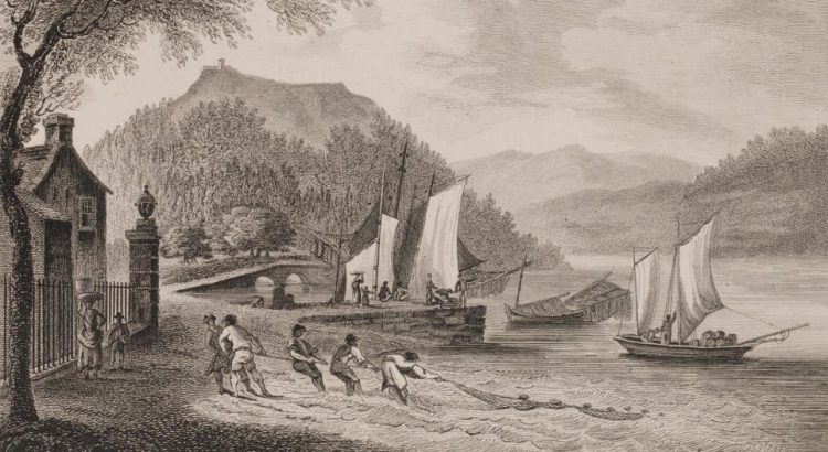
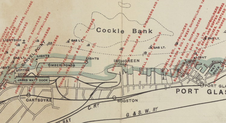
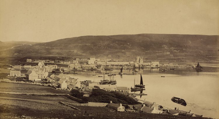
Part of the historic county of Renfrewshire, Inverclyde is situated in the crook of the upper Firth of Clyde as it bends east toward Glasgow. Its largest towns, Greenock and Port Glasgow, were historic centres of shipbuilding. From the eighteenth century they were key ports for the British trade in goods from overseas, including commodities, […]
Zoom into Clackmannanshire
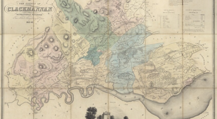
Collated by Charlotte James Robertson. This time in our ‘Zoom into…’ series the spotlight is on Clackmannanshire. Affectionately known as ‘The Wee County’ it is mainland Scotland’s smallest council area by population. Clackmannanshire borders the council areas of Stirling, Fife, and Perth & Kinross. The town of Clackmannan was the county town up until 1822 when Alloa became the main administrative centre. […]
Zoom into Na h-Eileanan Siar
Time to step into the rich history and culture of Na h-Eileanan Siar (Western Isles or Outer Hebrides). Na h-Eileanan Siar is an island chain off the west coast of Scotland. The inhabited islands of the Western Isles include: Lewis and Harris, South Uist, North Uist, Benbecula, Barra, Great Bernera, Berneray, Vatersay, Baleshare, North Grimsay, […]
Zoom into the Shetland Islands
Collated by Veronica Bell. The Shetland Islands are the most northerly part of the British Isles, lying in the North Atlantic between the British mainland, the Faroe Islands and Norway. The main town, Lerwick, lies only six degrees of latitude from the Arctic Circle.
Zoom into the Orkney Islands
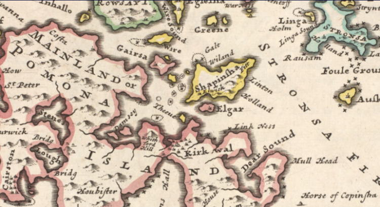
Collated by Alison Leslie. Orkney, or the Orkney Islands, is a group of 70 islands off the north coast of Scotland. They became part of Scotland in 1469 in lieu of an unpaid dowry from Norway. Today Orkney is best known for its historic sites, the dive sites around the scuttled World War One German fleet, its birdlife, its food and drink, and the North Ronaldsay sheep […]
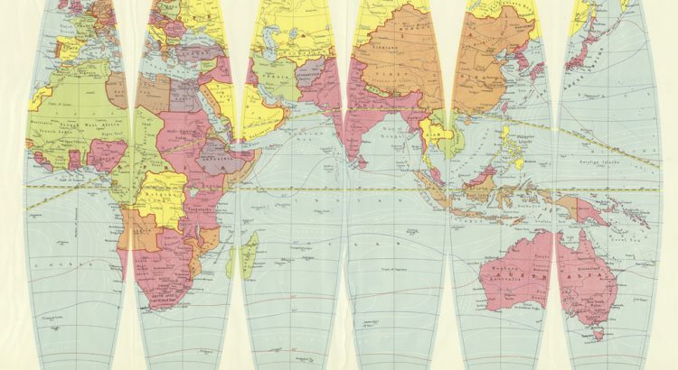
Mapping Around: Introducing Denoyer-Geppert’s Globe Gores
Examine a terrestrial globe and what do you see? A fascinating model of how we view the world? A historical snapshot of the various landmasses and water features we have encountered? Or are globes a political narrative reflecting the creator’s point of view?
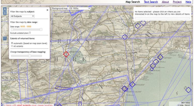
Setting up a web-mapping interface for the Stevenson Collection
Written by Rachel Dishington, Collaborative Doctoral Partnership PhD student at the University of Edinburgh, and Chris Fleet, Map Curator. In a previous blog post, we described in detail the process of geocoding the Library’s Stevenson maps and plans of Scotland. This process generated a file that linked metadata describing over 2000 maps and plans to […]
Map of the Month: Planning a Capital City
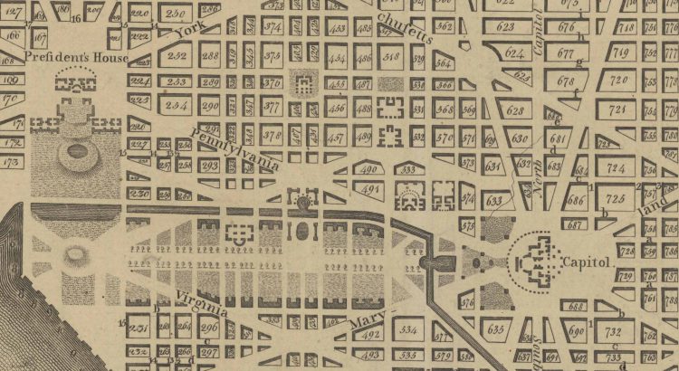
Planning of a New “Federal City” After the success of the American Revolution, Americans were faced with a decision: where to build their capital. In a foreshadowing of future conflict, the main debate was whether this monumental city should be built in the North of the South. The South was unhappy with economic decisions after […]
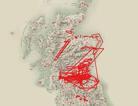
Geocoding the Stevenson Maps and Plans of Scotland
Written by Rachel Dishington, Collaborative Doctoral Partnership PhD student at the University of Edinburgh The Stevenson family of engineers worked extensively throughout Scotland during the nineteenth and early twentieth centuries. Their work focused primarily on coastal engineering projects, particularly harbours including at Peterhead as shown below. Most famously, they were responsible for the construction and […]