I remember the day, soon after I started as a Map Assistant in the Map Library, while searching for maps of France I opened a drawer and saw five aerial photos taken by the RAF after D-Day sitting beside large scale maps of the five D-Day landing beaches. I was, and still am, fascinated by them. One of the photographs and two of the maps are included in this blog.
Discovering these maps led me onto researching the Mulberry Harbours, and the role Scotland had in their testing and development. Testing of the different components took place at Garlieston in Wigtownshire.
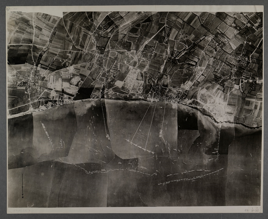
The photo below shows Mulberry B at Arromanches (Gold Beach). You can see the lines of scuttled ships (Gooseberries) providing a sheltered breakwater for the piers.
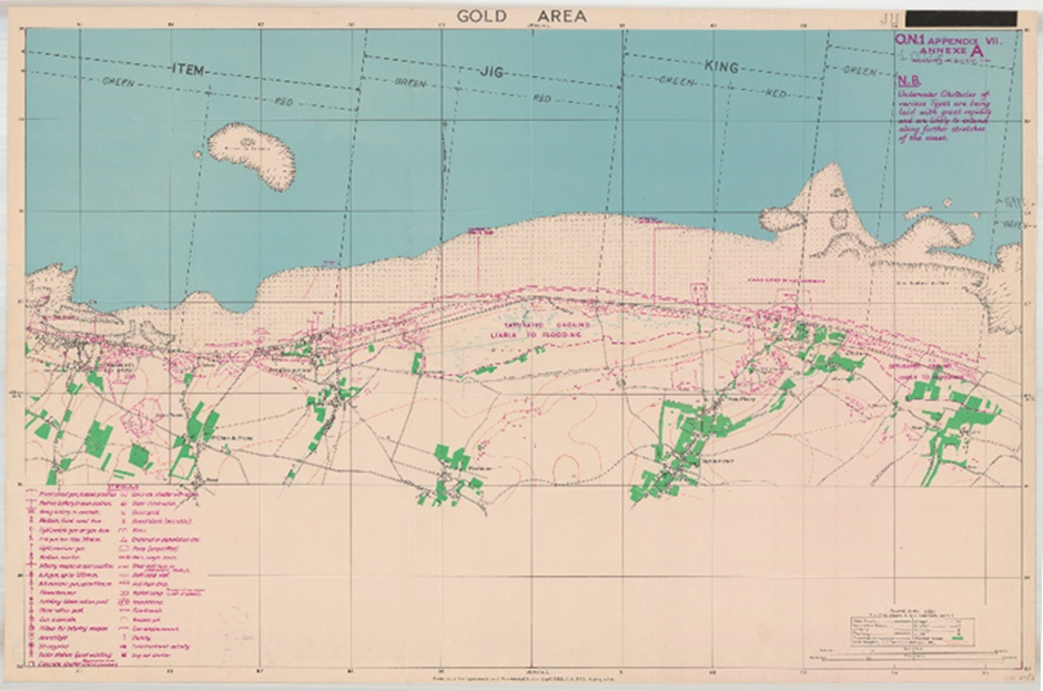
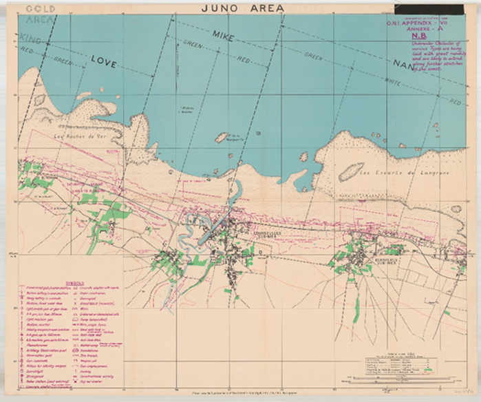
The large scale map of Gold Beach is shown below, with the different sectors and identified obstructions marked.
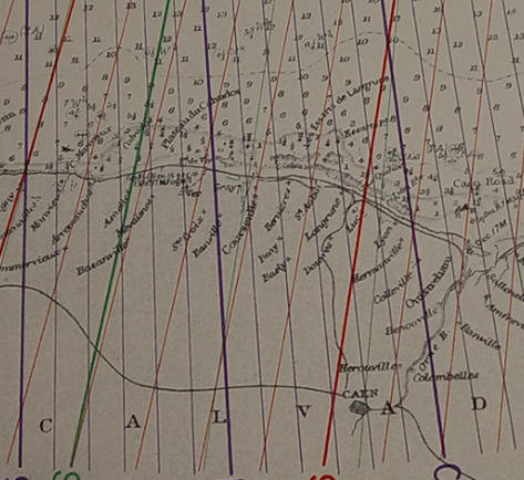
When the following map was donated to the Map Library, I matched it up with the large scale map of Juno Beach. The donated map has been hand annotated with arrows pointing to La Riviere from the caption “50 (N.) Div. Attack – 6/6/1944”. Ver-sur-mer has been underlined in blue crayon, and Bazenville in red ink with “BRIG.D+I” written above the town name.
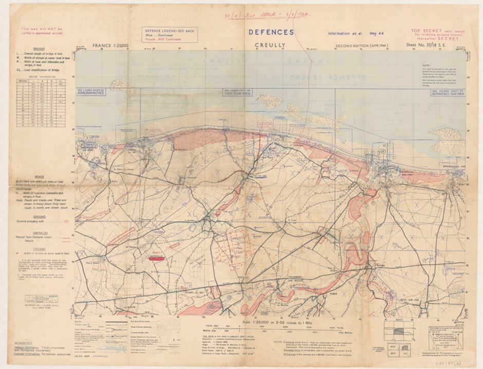
The following map shows that the 50 (N.) Division landed in the Love sector of Juno Beach.
During my research I heard about DECCA Charts for the first time. DECCA was being trialled by the Admiralty during the Second World War and was accurate to within 50 yards. The Map Library holds a small collection of DECCA charts. Below is an extract from DECCA sheet L.2675c, English Channel – Eastern Sheet showing Gold Beach.
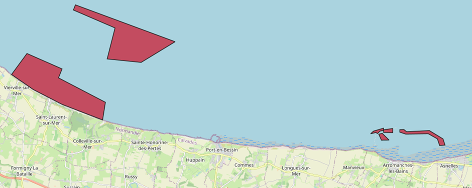
The remaining parts of Mulberry B can be seen on one of the UK Hydrographic Office Wrecks and Obstructions maps available to view in Legal Deposit Library Buildings. Below is a screenshot of the map showing the wrecks ofthe British and American Mulberry Harbours, along with an example of the information recorded about each wreck.
- Layer: bl_ukho_wrecks_and_obstructions_areas_2023
- Wreck ID: 23886
- Wreck Category:
- Obstruction Category:
- Status:
- Classification:
- Position: 49 21.298 N,0 38.27 W
- Latitude: 49 21.298 N
- Longitude: 0 38.27 W
- Depth: -4
- Height:
- Depth Method:
- Depth Quality: least depth known
- Water Depth: 9
- Water Level Effect: covers and uncovers
- Vertical Datum: Approximate Lowest Astronomical Tide
- Reported Year:
- Name: MULBERRY HARBOUR B (REMAINS OF)
- Type:
- Conspic Visual: not visually conspicuous
- Conspic Radar: not radar conspicuous
- Date Sunk:
- Original Source: national HO/authority charts
Nearer 6th June there will be information about the Mulberry Harbours themselves on this site.