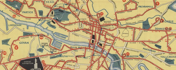
Collated by Jamie McIntosh. The final local authority area of our current Zoom Into series takes us to Glasgow, Scotland’s most populous city. Glasgow is situated in the west of the central belt area of the lowlands, and its city centre is dominated by the River Clyde. Glasgow’s position provides easy access to the greenery of the Loch […]
Category: 16th-century items
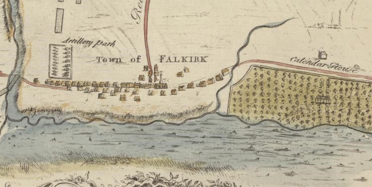
Zoom into Falkirk
Collated by Moray Teale. The Falkirk council area was formed in 1996 when the Central Region was divided into several parts. Falkirk boasts many varied attractions from the ruins of the Antonine Wall, Callendar House and Blackness Castle to the engineering feats of the Forth and Clyde Canal and the Falkirk Wheel. More recently it has become famous for the […]
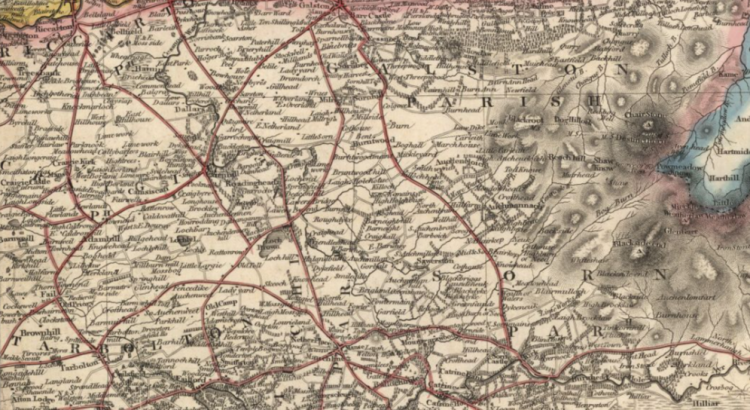
Zoom Into East Ayrshire
Collated by Emma Boyd East Ayrshire is a largely rural council area in the south-west of the country with a population of over 122,000 at the last census. The area was formed in 1996, from the former Kilmarnock and Loudoun, and Cumnock and Doon Valley districts; and the majority of people live in or around […]
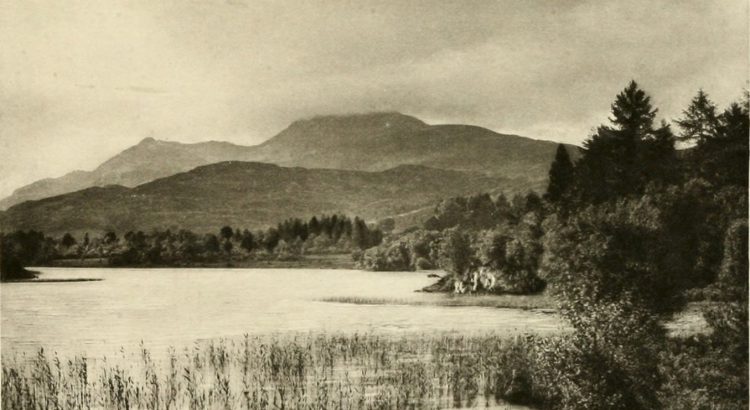
Zoom into Stirling
Collated by Jamie McIntosh. The Stirling authority area is at the heart of Scotland and spans the traditional boundary between the lowlands and highlands. To the west of the region sit the Campsie Fells and the Fintry Hills, which eventually give way to Loch Lomond. The boundary of the authority runs up the east side of the loch, taking in the Trossachs and Ben Lomond. The northern area of the authority is generally […]
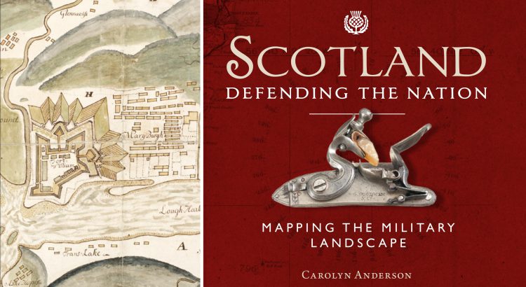
Scotland: Defending the Nation – Mapping the Military Landscape
Some of the most detailed and alarming military maps of Scotland were made by external aggressors, planning attack or invasion. Here we look at maps made by four of these countries: French charts, 1800s In the early 18th century, when Napoleonic France made preparations for an invasion of Great Britain, the best available charts of […]
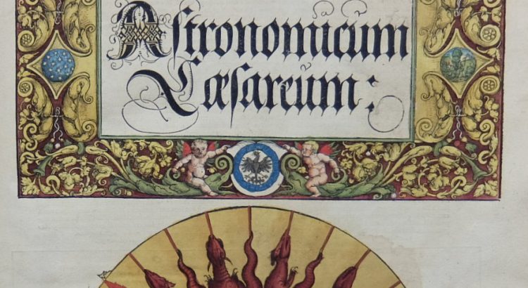
Astronomicum Caesareum
Peter Apian’s Astronomicum Caesareum (Ingolstadt, 1540) is one of the finest printed books in the National Library of Scotland, hand coloured throughout and featuring ingenious and beautiful volvelles. Apian, humanist mathematician and astronomer and born Bienewitz in Leisnig, Saxony (Biene is German for bee, hence the Latinizing of his name to Apian), was the son […]