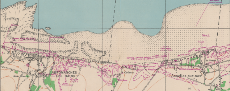
Swiss Rolls, Gooseberries and Hippos were all parts of the pre-fabricated Mulberry Harbours that were towed across the channel as part of the D-Day fleet, and constructed in situ on Gold and Omaha Beaches. Scotland played a large part in the production and testing of the Mulberry Harbours. Two Mulberry Harbours were built – Mulberry […]
Tag: Map Library
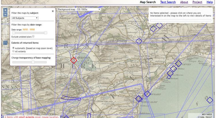
Setting up a web-mapping interface for the Stevenson Collection
Written by Rachel Dishington, Collaborative Doctoral Partnership PhD student at the University of Edinburgh, and Chris Fleet, Map Curator. In a previous blog post, we described in detail the process of geocoding the Library’s Stevenson maps and plans of Scotland. This process generated a file that linked metadata describing over 2000 maps and plans to […]
Geocoding the Stevenson Maps and Plans of Scotland
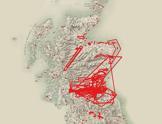
Written by Rachel Dishington, Collaborative Doctoral Partnership PhD student at the University of Edinburgh The Stevenson family of engineers worked extensively throughout Scotland during the nineteenth and early twentieth centuries. Their work focused primarily on coastal engineering projects, particularly harbours including at Peterhead as shown below. Most famously, they were responsible for the construction and […]
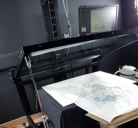
Digitising the Library’s Maps
By: Gabi Migdalska (Specialist Digital Production Operator ) and Rosemary Hall (Maps Assistant) The National Library of Scotland holds well over 1.5 million maps and counting. The collection ranges from manuscripts to single fold-out maps in books to Ordnance Survey series containing 1000s of sheets. Holding such extensive collections puts the Library in a unique […]