by Chris Fleet, Zekun Li, Katie McDonough, and Valeria Vitale. Maps are excellent documentary sources for understanding the history of the landscape, including past human activities and former physical environments. Many organizations have scanned tens of thousands of historical maps and shared them online. For example, the Sanborn Fire Insurance Map Collection scanned by the […]
Author: Chris Fleet
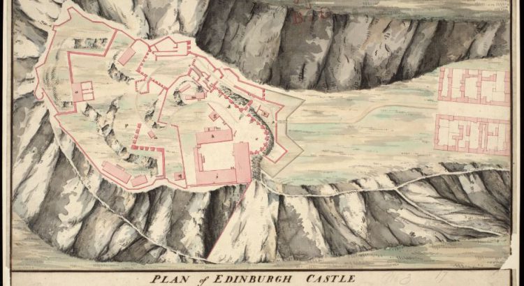
Zoom Into Edinburgh City
What do you think of when you think of the city of Edinburgh? Perhaps the ancient castle looming over the city from Castle Rock. Or the plethora of festivals that take place in the city’s streets every year. Maybe you know Scotland’s capital city best as the seat of the Scottish Parliament at Holyrood. But what else has taken place within […]
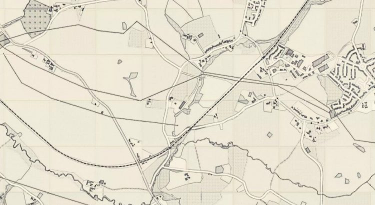
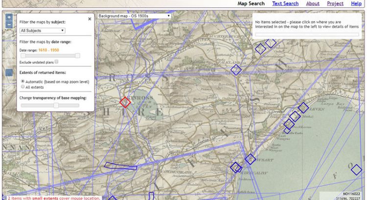
Zoom into Perth and Kinross
The county of Perth, formerly known as Perthshire, sits at the heart of Scotland, and its vast geographic size has seen it called ‘the big county.’ It existed as an administrative county from 1890 until 1930, when it was linked with Kinross-shire which, in direct contrast to its neighbour, is one of Scotland’s smallest counties. The county town is Perth, and a large number […]
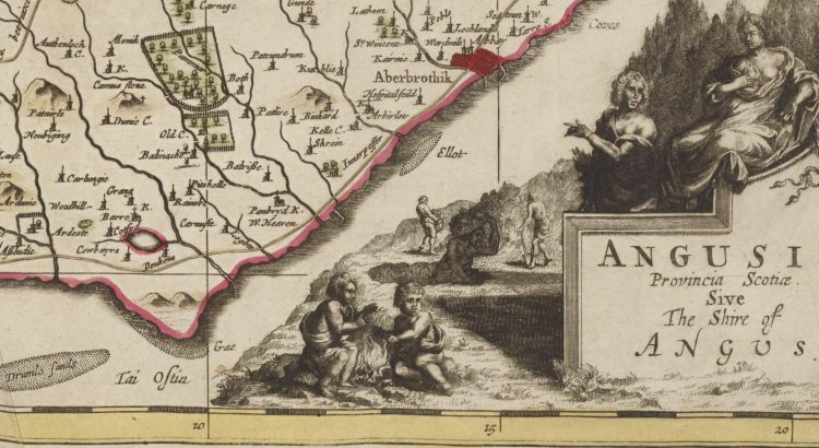
Zoom Into Angus
The Modern-day council area of Angus traces its name to an eighth century Pictish king, Óengus son of Fergus (ruled 732-761). Óengus (Angus) hailed from Circinn, one of the four principal Pictish kingdoms roughly coextensive with the modern county of Angus. The signing of the Declaration of Arbroath at Arbroath Abbey in 1320 marked Scotland’s establishment as an independent nation, and so Angus has become known as the birthplace of […]
Setting up a web-mapping interface for the Stevenson Collection
Written by Rachel Dishington, Collaborative Doctoral Partnership PhD student at the University of Edinburgh, and Chris Fleet, Map Curator. In a previous blog post, we described in detail the process of geocoding the Library’s Stevenson maps and plans of Scotland. This process generated a file that linked metadata describing over 2000 maps and plans to […]
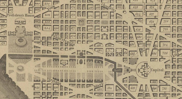
Map of the Month: Planning a Capital City
Planning of a New “Federal City” After the success of the American Revolution, Americans were faced with a decision: where to build their capital. In a foreshadowing of future conflict, the main debate was whether this monumental city should be built in the North of the South. The South was unhappy with economic decisions after […]
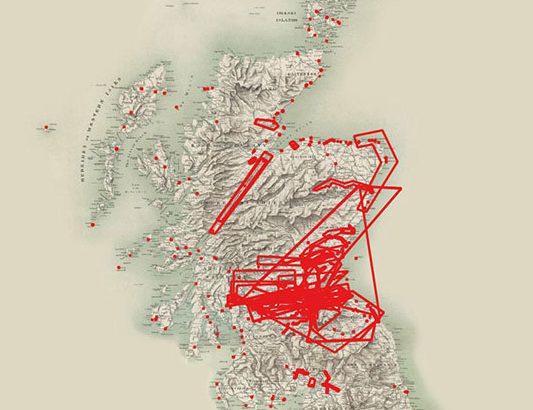
Geocoding the Stevenson Maps and Plans of Scotland
Written by Rachel Dishington, Collaborative Doctoral Partnership PhD student at the University of Edinburgh The Stevenson family of engineers worked extensively throughout Scotland during the nineteenth and early twentieth centuries. Their work focused primarily on coastal engineering projects, particularly harbours including at Peterhead as shown below. Most famously, they were responsible for the construction and […]
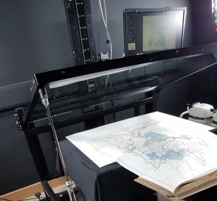
Digitising the Library’s Maps
By: Gabi Migdalska (Specialist Digital Production Operator ) and Rosemary Hall (Maps Assistant) The National Library of Scotland holds well over 1.5 million maps and counting. The collection ranges from manuscripts to single fold-out maps in books to Ordnance Survey series containing 1000s of sheets. Holding such extensive collections puts the Library in a unique […]
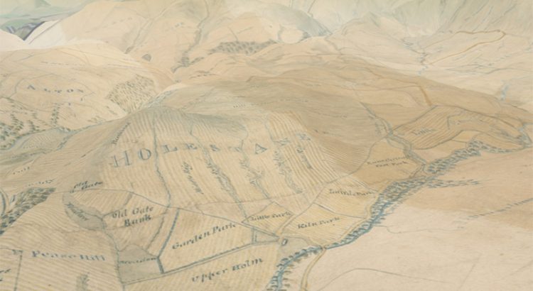
Scotland from above – our 3D map viewer with new vertical exaggeration
In early 2016 we launched our 3D map viewer, allowing our georeferenced maps to be viewed from a bird’s-eye perspective. This combines our historic map layers with elevation data, so that they can be draped and visualised across a real landscape in three dimensions. Whilst the viewer has been popular, we have recently added a […]
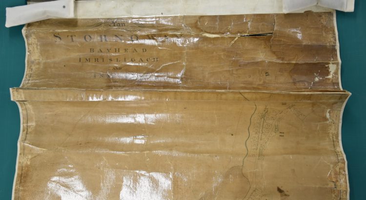
Conserving the map of Stornoway by James Chapman, ca. 1800
The Stornoway map is one of a group belonging to Stornoway Public Library, which were sent to the Library in 2017 for digitisation. However, the map could not initially be digitised due to its poor condition. It had been heavily conserved in the past, leaving the paper stained, skinned and distorted, with many large cracks, […]