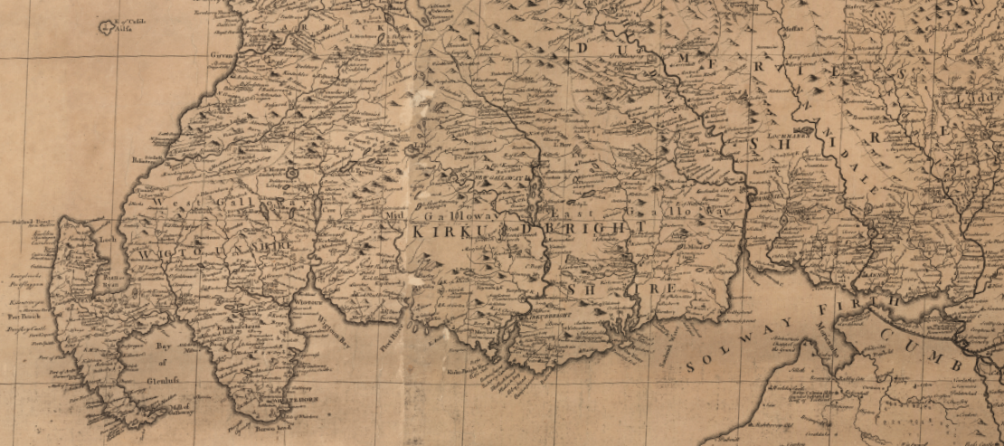
The unitary region of Dumfries and Galloway was created in 1975, following a reorganisation of Local Government in Scotland. It brought together the historic counties of Dumfriesshire, Wigtownshire and the Stewartry of Kirkcudbright.
https://maps.nls.uk/mapmakers/name/Dorret
Though now part of Scotland, the region was once part of the ancient Northern Brittonic Kingdom of Rheged and later the Kingdoms of Strathclyde and Northumbria. Given its location in southwest Scotland, its history has been influenced by the Picts, Romans, Angles, Vikings, Danes, English and Scots. This is reflected in the variety of place-names throughout the region, and one can find examples of Cumbric – a Northern Brittonic language closely related to Welsh – Old Norse, Old English, Gaelic and Scots. There are examples of Roman, Medieval and Ecclesiastical archaeology throughout the region, with many historical sites now popular tourist attractions.
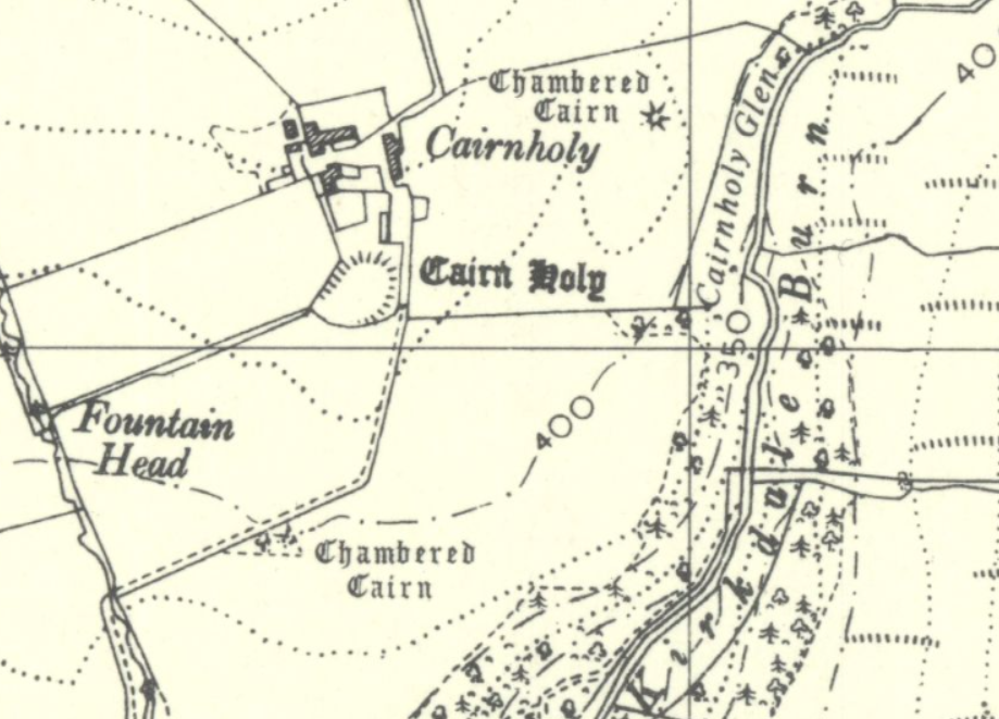
Cairn Holy overlooking Wigtown Bay are Neolithic burial monuments linked to the
mythical Scottish King Galdus.
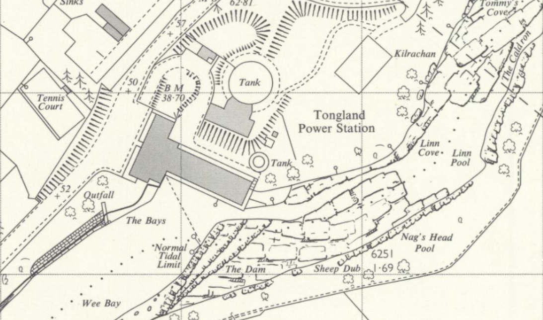
The natural resources of the region have long been utilised. While much of the forested areas are of ancient woodland, the Forestry Commission owns extensive plantations in the region, while Forests at Mabie, Ae, and Dalbeattie offer nature reserves for wildlife but also trails for walking and cycling. The Galloway Hydro-Electric Power Scheme was the first large-scale hydro-electric power scheme in Scotland, becoming operational in 1935; though not on the same scale as later hydro-electric schemes in the Highlands, the Galloway Hydro-Electric Power Scheme had a distinct character, with several of its power stations – such as the turbine hall at Tongland – designed in the modernist style.
Very much a rural part of Scotland, there is varied landscape throughout Dumfries and Galloway, with agricultural fields and pastures, the rolling Galloway Hills, and many forests and lochs. At the heart of the region is the Galloway Forest Park. Covering nearly 300 square miles, it was first established in 1947 and in 2009 was declared Scotland’s first Dark Sky Park, where light pollution is restricted and conditions are perfect for stargazing. At the southern end of Dumfries and Galloway, its coastline runs along the Solway Firth. One of the largest estuaries in the British Isles, much of the Solway Firth is a designated conservation area and contains several nature reserves. Its coastline is varied and runs from salt marshes and mires in the east; sandy beaches; to the rugged cliffs of the Mull of Galloway in the west. The significance the sea played to local communities is reflected in the number of key towns situated along the region’s coastline – Stranraer, Wigtown, Whithorn, and Kirkcudbright.
The region has contributed many significant figures who have made their mark in various fields. J.M. Barrie, Thomas Carlyle, and Robert Burns are among the important literary writers and poets who have lived in the region. Other notable figures include John Paul Jones – commander of the fledgling United States’ Navy – who was born in Kirkcudbrightshire; Thomas Telford – the famous civil engineer – who was born near Westerkirk in Eskdale; the actor John Laurie was born in Dumfries and for many years his family ran a hatter and hosiery business at the town’s Church Place; and Jane Haining, the Scots Missionary who died in Auschwitz concentration camp, was born in Dunscore and attended Dumfries Academy. More recently, the likes of the racing driver and commentator David Coulthard , actor Sam Heughan, and music producer Adam Wiles (aka Calvin Harris) have helped put Dumfries and Galloway on the map.
Where to find local collections:
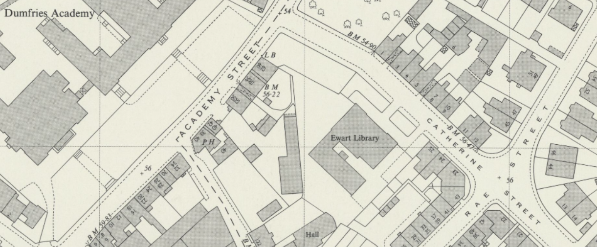
Ewart Library,
Catherine Street,
Dumfries
DG1 1JB
Tel: 01387 260285
E-mail: libarchive@dumgal.gov.uk
URL: https://www.dumgal.gov.uk/article/15308/Local-archives
Book – non fiction
One of the distinct geographical features of the Solway Firth is Luce Bay (https://maps.nls.uk/view/197253157). It is a shallow bay that lies between the Machars and the Rhinns of Galloway in Wigtownshire. At its head it is 10.5km wide, while it is 31km at the widest part of its mouth between the Mull of Galloway and Burrow Head. It is now a designated Special Area of Conservation, whose natural habitat is monitored by Scottish Natural Heritage:-
Book – fiction
Originally published as a weekly serial in The Sunday Mail, Wigtown Ploughman: Part of His Life was the 1939 debut novel by John McNeillie:-
https://search.nls.uk/permalink/f/sbbkgr/44NLS_ALMA21460469310004341
It is the tale of Andy Walker, as he attempts to rise through the tenant-farmer system in Galloway, while contending with violence, drunkenness and immorality in the rural southwest. Though the main narrative is written in English, McNellie’s characters use broad Galloway Scots.
Gallowa Scots haes a wheen wirds an pronunciations lanerly tae the soothwest, tho these can chynge whan traivelin atween districks. In the mair westren pairt cried the Rhins the Irish influence is mair tae the fore an is whiles kent as ‘Galloway Irish’. Stranraer haes a puckle o braw wirds still in common yaise sic as ‘stenter’ for claes-pole an ‘fecket’ fir jaiket. You can learn mair aboot Wigtown Plougman an’ Gallowa Scots @ https://wee-windaes.nls.uk/wigtown-ploughman-an-gallowa-scots/
Film
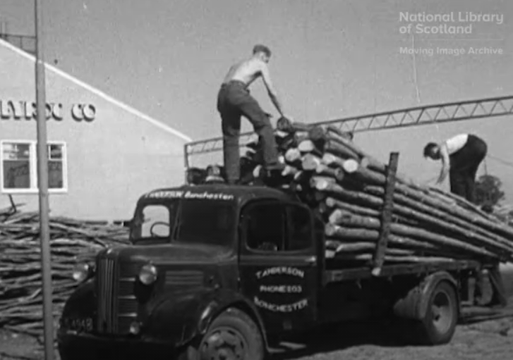
The Solway Counties was filmed in 1955 and offers a survey of the three Solway Counties of Wigtown, Kirkcudbright and Dumfries. It was produced by the Scottish Educational Film Association (SEFA), which looked to promote the use of films as educational aids. As such, the film highlights examples of agriculture, forestry, factory work and other industries and trades active in the region:- https://movingimage.nls.uk/film/1792

In 1963, SEFA produced Dumfriesshire Journey, a tour of some of the historic sites throughout the County:- https://movingimage.nls.uk/film/0796
Manuscript
The Sweetheart Breviary is one of the most significant additions to the Library’s collections in recent years. Sweetheart Abbey near Dumfries was founded in 1273 and was the last Cistercian monastery to be established in Scotland. Its founder was Lady Dervorgilla de Balliol, the mother of King John Balliol of Scotland, in memory of her husband; following her death in 1290, she was laid to rest next to her husband’s embalmed heart and so the Abbey was named in her memory. The Breviary was written in the first half of the 14th-Century and, unlike other surviving liturgical manuscripts from the period, is a complete volume. Its 200 vellum leaves contain the text of monastic prayers which would have been used throughout the year in Medieval Scotland:- https://digital.nls.uk/early-scottish-manuscripts/archive/131619877
Maps
This map of Gallovidia, vernacule Galloway appears in Joan Blaeu’s Atlas Novus, which he published in Amsterdam in 1654:-
https://maps.nls.uk/view/00000408
The maps in Blaeu’s Atlas of Scotland are based principally the work of Timothy Pont and were accompanied by textual descriptions of Scotland and its regions. Of Gallovidia it notes:
The region rises in hills everywhere, which are more productive for feeding herds than growing crops. The inhabitants engage in fishing both in the surrounding sea and in the rivers and lochs which flow everywhere below the hills; from these at the autumnal equinox they catch in boxes an incredible number of very tasty eels, whence they make no less profit than from the tiny horses with compact, strong limbs for enduring toil which are exported from here.
Before the establishment of the Ordnance Survey, Estate Plans often offered the most detailed maps of rural parts of Scotland. Of the three counties of Dumfries and Galloway, there are many such maps, dating from the 18th Century onwards, @ https://maps.nls.uk/estates/
The National Library’s Map collections include extensive holdings relating to Dumfries and Galloway, including many pre-Ordnance Survey maps and estate plans. The National Library has collaborated with the Dumfries Archival Mapping Project (DAMP) to help make such maps available for educational, cultural and general interest purposes – https://geo.nls.uk/maps/damp.html
An E-resource
There are several newspaper databases which are available through the eResources which offer full text of historical copies of many of the newspapers to have been published in the region:-https://auth.nls.uk/eresources/browse/subject/99
For example, the British Newspaper Archive includes issues from the likes of the Dumfries and Galloway Standard; Annandale Observer and Advertiser; Eskdale and Liddesdale Advertiser; Galloway News and Kirkcudbrightshire Advertiser; and the Galloway Gazette.
A Business
Apparently still the place to be on a Saturday night out in Dumfries, the Hole I’ The Wa’ Inn is one of the town’s oldest drinking establishments, having first opened in 1620:-
https://maps.nls.uk/view/74415256#zoom=6&lat=4434&lon=5246&layers=BT
At one time the Inn sat on a lane – the Mid Row – which ran parallel to the town’s High Street but the expansion of surrounding buildings mean that it is now accessed from a narrow close off the High Street, hence it’s name. As with many public houses, the Inn used its associations with Robert Burns as a marketing tool, as reflected in this advertisement which appeared in the Dumfries and District Post Office Directory (general, street, and trade directory), for 1911 and 1912:- https://digital.nls.uk/directories/browse/archive/85537680.
The Inn’s “Repository of Burns Relics” apparently included “his original honorary Burgess Ticket presented by the Royal Burgh of Dumfries to him” in 1787; autographed songs and letters; as well as “part of his household effects”.
A person
Though born at 14 India Street, Edinburgh, James Clerk Maxwell spent much of his life at his family’s Dumfriesshire home, Glenlair House near the village of Corsock. Considered to be the father of modern physics, Maxwell’s contribution to science has long been recognised in professional circles, but in recent years he has received more recognition from the wider public and, as such, was voted Scotland’s top scientist in an online poll for the National Library:-
https://digital.nls.uk/scientists/biographies/james-clerk-maxwell/index.html
A Ghost
Spedlin’s Tower (https://canmore.org.uk/site/66237/spedlins-tower) is a recently restored tower house on the west bank of the River Annan, north of Lochmaben. It was once the traditional seat of the Jardines of Applegirth, who had judicial responsibilities over the area.
In the late 17th-Century, the then lord, Sir Alexander Jardine, had cause to temporarily imprison the local miller, James Porteous, in the Tower’s dungeon. Called away to Edinburgh on urgent business, on arriving at the capital several days later, Sir Alexander discovered he still had the keys to the dungeon and in his haste had forgotten to release Porteous who had now been imprisoned for many days. Jardine dispatched a servant back to Spedlin’s Tower to release Porteous but by the time Jardine’s man reached the dungeon it was too late. Porteous was found dead but, in the throes of starvation, had eaten parts of his own body in a futile attempt to survive.
As a result of his tormented death, Porteous’ spectre was said to haunt the Tower and its occupants. So frequent were the ghost’s visitations upon the Jardine family that a clergyman was employed to exorcise the spirit. After a struggle which was claimed to last a full day, the clergyman succeeded in confining the spirit to the dungeon, though its shrieks and cries were often still heard. Legend has it that the ghost’s containment depended on the ancient bible the exorcist had used being kept in the Tower, but when the bible once had to be rebound the ghost’s activities increased once more, and it pursued the family to their new home of Jardine Hall on the east bank of the river – it was only when the bible was restored to the Tower once more that the hauntings ceased.
https://maps.nls.uk/view/82876287#zoom=5&lat=3795&lon=5918&layers=BT
This was one of the tales cited by Sir Walter Scott in the introduction to the 1839 edition of his Minstrelsy of the Scottish border : consisting of historical and romantic ballads, collected in the southern counties of Scotland; with a few of modern date, founded upon local tradition:-
https://deriv.nls.uk/dcn23/8060/80600435.23.pdf
It was also referred to by the Reverend Thomas Marjoribanks in the New Statistical Account of the Parish of Lochmaben:-
A Castle or other historic building
Caerlaverock Castle is a distinctive triangular fortress surrounded by a moat, near the shores of the Solway Firth:- https://maps.nls.uk/view/74942387#zoom=6&lat=6099&lon=8527&layers=BT.
Volume 1 of the Topographical, Statistical, and Historical Gazetteer of Scotland offers a description of the Castle and its history:- https://digital.nls.uk/gazetteers-of-scotland-1803-1901/archive/97440666
The Castle was besieged on several occasions by various armies and was eventually abandoned in the 17th-Century. An engraving which shows the ruinous state of the Castle in the 18th-Century can be found within the Blaikie Collection of Jacobite prints and broadsides:- https://digital.nls.uk/75242351
The Castle is now maintained by Historic Environment Scotland, while the surrounding land is a protected nature reserve. For hundreds of years, the Castle was the principal seat of the Maxwell family. The Book of Caerlaverock; Memoirs of the Maxwells, Earls of Nithsdale, Lords Maxwell & Herries by William Fraser was privately printed for William Lord Herries in Edinburgh in 1873. A two-volume work, it details the history of the Maxwell family and their tenure at Caerlaverock played:-
Food
Written in Dumfries in 1722, A Large collection of choice recipes for cookrie, paistrie, milks, sauces, candying, confectionating, and preserving of fruits, flowers, &c. is divided into “five books” and contains recipes for “1. Paistrie. 2. Milks, &c. 3. Cookrie. 4. Fruits, Flowers, Pickles & Colouring. 5. Biskets & Cakes”:-
https://digital.nls.uk/102621604
A photograph
“Calotypes” were an early photographic process developed by William Henry Fox Talbot. The Edinburgh Calotype Club is the oldest photographic club in the world and the collections of its first photographs are arranged in two volumes, one held at the National Library of Scotland, with a second volume at Edinburgh Central Library. These were not only of subjects in Edinburgh but include photographs of subjects throughout Scotland; these include this image of Craigielands House, near Beattock:
https://digital.nls.uk/pencilsoflight/searchDetail.cfm?startRow=1&totalRows=1&startRowNext=2&rowsPerPage=1&startRowBack=0&localArea=Dumfriesshire&country=0&photographer=0&keyword=0&highlight=0&talbotype=0&flag=1
The House appears on OS Maps: https://maps.nls.uk/view/74944279#zoom=5&lat=10154&lon=5859&layers=BT
Something about the County Town
Although in a rural part of Scotland, Dumfries has not been isolated from international events. During the Second World War, Dumfries became home to the Norwegian Army in exile, with thousands of Norwegian servicemen based around the town. The Rosefield and Troqueer Mills on the southern banks of the River Nith became makeshift barracks for many of the Norwegians:-
https://maps.nls.uk/view/82876770#zoom=5&lat=6091&lon=4503&layers=BT
Servicemen from other occupied nations – Dutch, Czechs and Poles – also took part in manoeuvres in the surrounding countryside. There were often football matches between the various units and local teams. For example, on Saturday, 25th January 1941, an Inter-Allied Football Match took place between a Dutch team and a Norwegian team, as part of a series of matches in “aid of the welfare funds the different Allied units”; the match ended in a 3-3 draw and was played at the town’s Palmerston Park, home of Queen of the South F.C.:-
https://maps.nls.uk/view/188149875#zoom=7&lat=4550&lon=3007&layers=BT
The Norwegians became a significant feature of life in Dumfries and they were given a former restaurant on the town’s Church Place, which became Norge Hus (Norway House), a cultural and social hub for them during their time in the town:-
https://maps.nls.uk/view/82876527#zoom=6&lat=1672&lon=3404&layers=BT
Something about a village or small place
The village of Ruthwell was home to the world’s first modern savings bank:-
https://maps.nls.uk/view/74945167#zoom=5&lat=8193&lon=10229&layers=BT
The bank was established in 1810 by Dr Henry Duncan. Duncan had been ordained as Minister of Ruthwell Parish in 1799 and spent much of his tenure attempting to improve the impoverished conditions in which his Parishioners lived. Reviving the local Friendly Society, in 1800 he persuaded the landowner, the Earl of Mansfield, to permit him the use of a derelict cottage in the village. Duncan used the cottage as a hub for his efforts to improve the community’s lot, distributing food, and eventually the savings bank. As well as his Parishioners, Duncan was interested in the history of the Parish and was a keen antiquarian, restoring the Ruthwell Cross, an inscribed Anglo-Saxon Cross dating from the 8th-Century and which had been broken during the Reformation. Duncan provided a detailed account of the Parish of Ruthwell in the New Statistical Account of Scotland published in 1845, and reflects the extent of his interests:-
Duncan later became a leading figure in the early Free Church and it was through the “indefatigable exertions of its founder, the merits of banks of the kind for popular use were speedily acknowledged by statesmen and philanthropists of all classes” (Annals of the Free Church of Scotland by Rev. W. Ewing [1914]). Duncan established a Free Church and Manse at Mount Kedar, on the road between Mouswald and Ruthwell, north-west of the Glasgow & South-Western Railway Line; it was described as being “surrounded with gardens and grounds which [Duncan] had laid out with exquisite taste” and “one of the finest residences of the kind in Scotland”. Following Duncan’s death in 1846, a pyramid-shaped monument was erected at Mount Kedar in his memory:
https://maps.nls.uk/view/74426687#zoom=7&lat=3889&lon=9458&layers=BT
Further reading
The Poets of Dumfriesshire (1910) was written by Frank Miller of Annan – https://search.nls.uk/permalink/f/1jc5lod/44NLS_ALMA51591337810004341. It offers not only a literary history, but also an antiquarian and historical overview of poems and ballads from the region, both ancient and modern. In compiling this work, Miller drew upon records held by the likes of the British Museum, the Advocates’ Library, and other respected collectors. The author draws attention to several poets who are hitherto unknown outside the region; for example, Ballantyne Ferguson, a Gretna farmer who died in 1869, aged seventy-one, and who produced a number of tales and poems, one of which – Young Bridekirk – would be published by the Annandale Observer after his death. A digitised version of Miller’s work has been uploaded onto the Internet Archive:- https://archive.org/details/poetsofdumfriess00mill
Studies in the Topography of Galloway (1887) contains details of nearly 4000 placenames, with notes on their origin and meaning. It was written by Sir Herbert Eustace Maxwell (1845-1937). Descended from the Maxwells of Caerlaverock, Maxwell was President of the Society of Antiquaries of Scotland and one of the first Chairs of the National Library of Scotland. He was a keen antiquarian and wrote several important works on the history of the region: – https://digital.nls.uk/82082297
Guy Mannering; or The Astrologer (1815) was the second in the Waverly Novels series written by Sir Walter Scott, and was largely set in Galloway.
It proved an immediate success; its Edinburgh printed run sold out in a single day and, owing to its popularity, over the course of Scott’s life there would be 11 editions published. This edition was published in Glasgow in 1870 by David Wilson of Maxwell Street:- https://digital.nls.uk/107396291