Swiss Rolls, Gooseberries and Hippos were all parts of the pre-fabricated Mulberry Harbours that were towed across the channel as part of the D-Day fleet, and constructed in situ on Gold and Omaha Beaches. Scotland played a large part in the production and testing of the Mulberry Harbours.
Two Mulberry Harbours were built – Mulberry A for the Americans at Omaha Beach, and Mulberry B for the British at Gold Beach.
Scottish links
More than one hundred Scottish firms sent over 30,000 tons of steelwork and machinery over to Normandy, with 83% of the pierheads being supplied from 3 sites in Scotland. Two of the Scottish firms involved were the Renfrew based specialist dredger firm of Lobnitz & Company, and Alexander Findlay & Co of Motherwell. Findlay’s also had a yard at Leith, where 13 Spud pierheads and 16 Beetle pontoons were built.
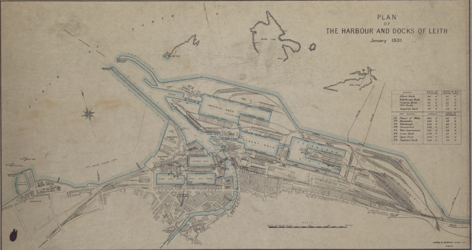
Plan of the harbour and docks of Leith, January 1931. NLS shelfmark Signet.s.112. CC-BY-NC-SA (Signet)
Three pierheads were built at Cairn Ryan by the Port Construction and Repair Companies. The Cairn Ryan pierheads had their legs fitted at Faslane, while those manufactured in Leith had their legs fitted at Southampton. With steel in short supply switching from riveting to the relatively new technology of welding helped to save considerable amounts of metal.
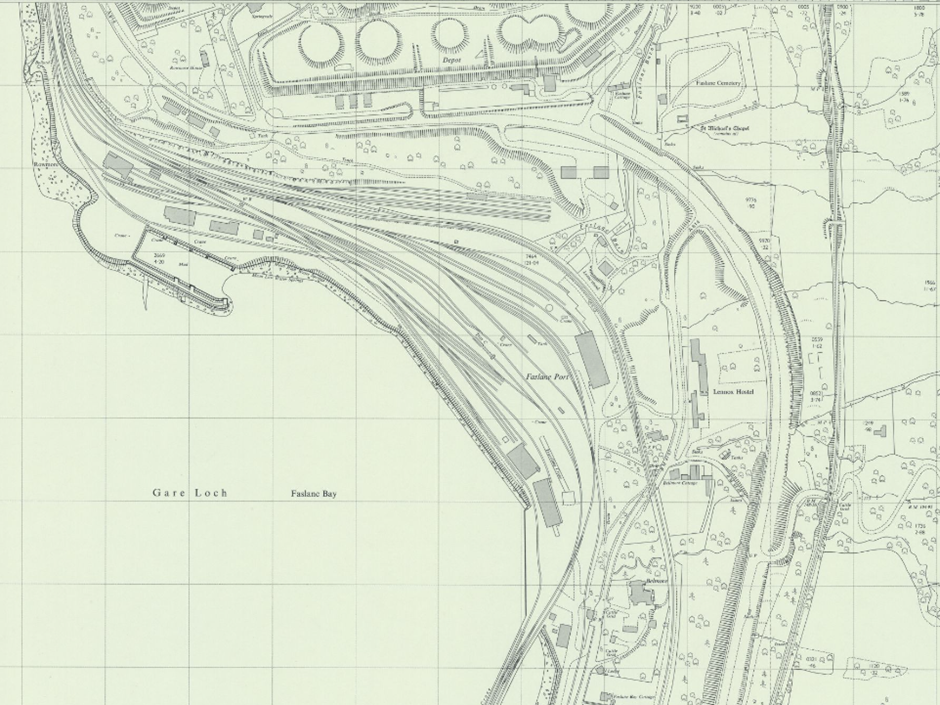
Extract from Ordnance Survey 1:2,500 scale map NS2489-NS2589 – AA revised: 1968, Published: 1969
Official Specifications
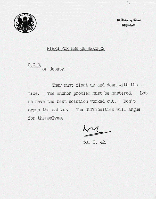
In May 1942 Winston Churchill issued a memo relating to “Piers for use on beaches” which started the whole project. The reasoning behind these piers was to save lives and equipment which would otherwise be lost in the fight for already damaged, or destroyed, harbours and quaysides.
By War Office official photographer, Lockeyear W T (Capt) – http://media.iwm.org.uk/iwm/mediaLib//301/media-301180/large.jpgThis photograph H 41067 comes from the collections of the Imperial War Museums., Public Domain, https://commons.wikimedia.org/w/index.php?curid=30910075
By the autumn of 1942 specifications had been issued for the pierheads and piers required. Each harbour was to be roughly the same size as Dover harbour, with a proposed life of 100 days. When at full capacity each harbour would be capable of handling 12,000 tons of stores and 2,500 vehicles per day. By 10th June (D+4) an area of sheltered water would be established, and by 20th June (D+14) the harbours would be capable of receiving ships.
A date for the start of the trials was set for May 1943.
Deciding on a test site
The testing for these harbours was done in Wigtown Bay at Garlieston. Garlieston was one of many sites around Britain linked to the Mulberry Harbours, and the only one where extensive sea trials took place. Despite German spy planes flying over Wigtown Bay, the importance of the area was never realised.
Garlieston was chosen as the test centre for four reasons :
Reason 1
There was reasonable access to beaches with a similar rise and fall tide pattern to the Normandy beaches selected for the invasion, as well as having occasional rough seas.
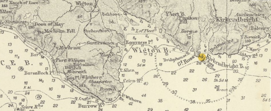
Extract from Kriegsmarine Sheet 376 – Irische See showing Wigton Bay. Published: 1944
Reason 2
Garlieston is a remote area away from centres of population.
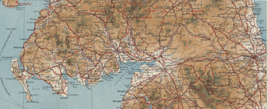
Extract from Scottish Youth Hostels Touring Map of Scotland, Published 1944.
Reason 3
Garlieston Harbour is ideally placed to accept equipment by rail or sea.
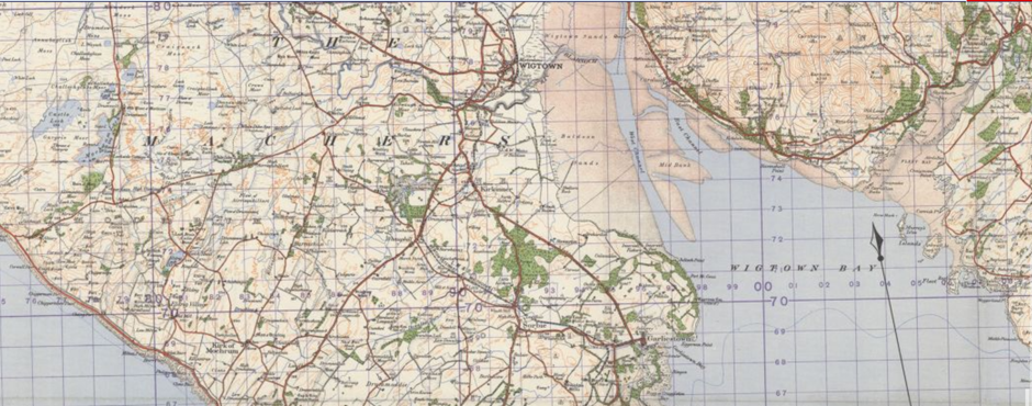
Extract from War Office, Scotland 1-inch Popular. GSGS 3908 1933-43, Sheet 91 Wigtown. War Revision 1940.
Reason 4
The bay was not already being used by the military.
Components
Where possible, official photographs from the Imperial War Museum will be used to show what the different parts looked like.
Each Mulberry harbour consisted of different structures joined together :
- Bombardon – floating outer breakwater. One of 3 breakwater elements.
- Gooseberry – static outer breakwater consisting of scuttled ships.
- Phoenix – large reinforced concrete caissons sunk as part of the breakwater.
- Beetle – floating pontoon support for Whale.
- Whale – floating roadway connecting Spuds to land.
- Spud – floating pierheads on adjustable legs. Gooseberries
Gooseberries were lines of scuttled ships at the end of their working lives which provided a sheltered breakwater. Once suitable merchant ships had been identified they were taken to Rosyth, Methil and Oban to be converted. After the landings had taken place the first of these ships were to arrive and be scuttled in the areas where the Mulberry harbours would be built. Five Gooseberries were to be used as part of the Mulberry harbours, with 3 forming basic breakwaters at Utah, Gold and Sword beaches. Fifty nine obsolete merchant and warships in the construction of the Gooseberries. One of the scuttled ships, HMS Centurion had seen action during the First World War at the Battle of Jutland. This armada gathered at Oban before sailing to Normandy and being scuttled where required.
1:12,500 scale map of Utah Beach
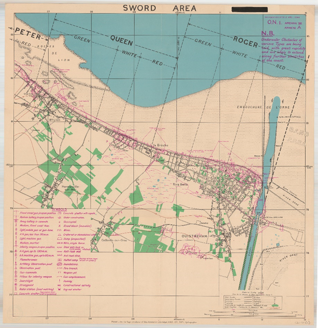
1:12,500 scale map of Sword Beach
The photograph below shows part of Sword Beach.
Riva Bella (Ouistreham I) (6 Gun Battery (wooden dummies substituted) and 4 casements under construction) GSGS 4347/40/16NW/115798 2031 of RB/618
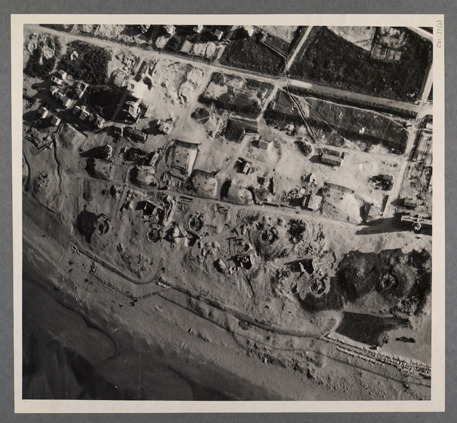
Phoenixes
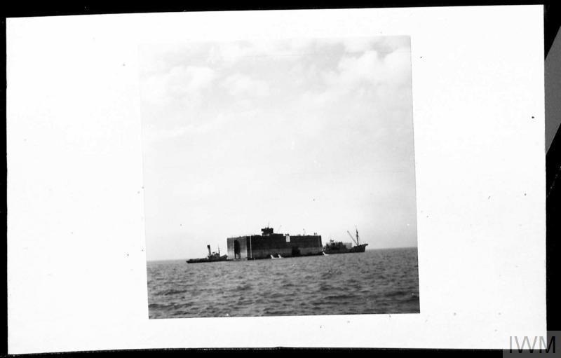
After the Gooseberries were in place, it was the Phoenixes’ turn. These floating piers consisted of large concrete caissons of different sizes which were sunk to form part of the breakwater with the Gooseberries. Then it was the turn of the adjustable floating pier heads, or Spud pier heads. The Spuds had adjustable legs which could be adjusted depending on the tide. Lobnitz & Company in Renfrew assisted in producing the Spuds, but their yard did not have the capacity for fabrication. Six miles of Whales connected the Spuds to land. Whale was the codename given to the floating pierheads and roadways.
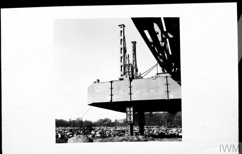
Hippos
Hippos were the concrete caissons that formed part of the Hughes Pier, one of the 3 prototypes tested for the Mulberry Harbours. They were designed by Welshman Hugh Iorys Hughes. Crocodiles, constructed of tubular steel, were then laid on top of the Hippo to create a roadway. This is shown in the photograph below. The Crocodiles were constructed of tubular steel. The major drawback of the Hughes Pier was that it could not rise and fall with the tide. However, the work that went into creating the concrete caissons assisted with the further development of the Mulberry Project.
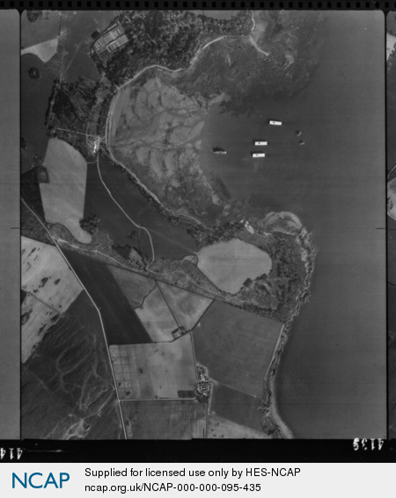
Prototype pontoon sections pictured at Rigg or Cruggleton Bay. Higher resolution images are available from NCAP.
The National Collection of Aerial Photography is one of the world’s largest collections of aerial photographs.
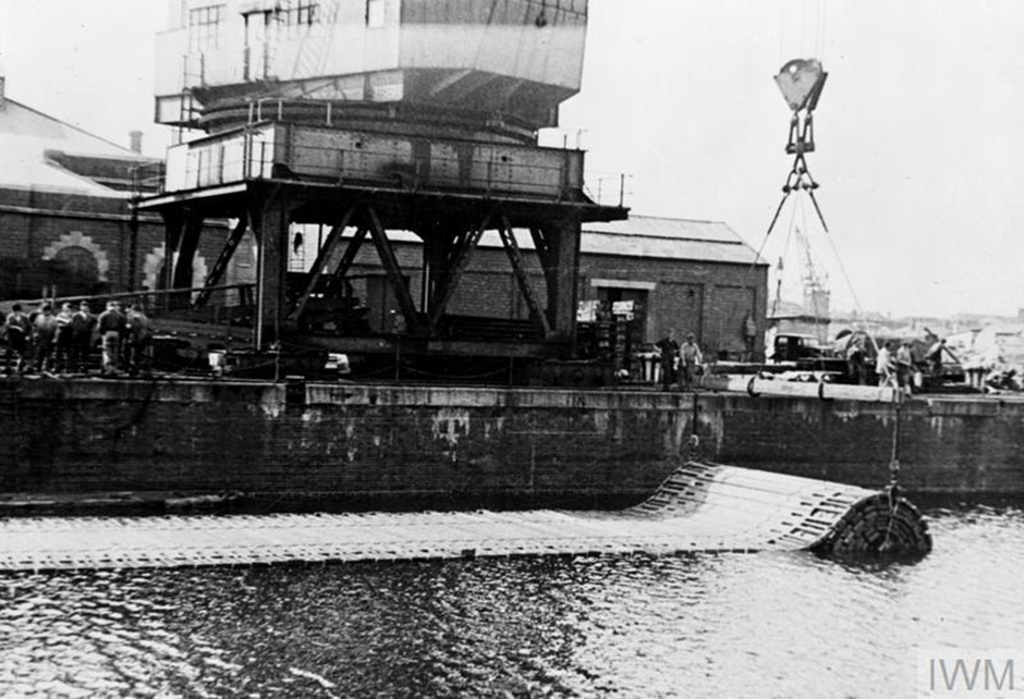
Beetles
Beetle was the codename given to the anchored pontoons supporting the Whales (steel-span bridges). Each Beetle required a good deal of steel for its construction. The design was adapted to enable it to be constructed steel and reinforced concrete, due to the lack of skilled welders, and the shortage of steel. Their legs could be adjusted according to sea conditions to provide strong bridging sections for the floating roadways.
Original wartime caption: Beetles with telescopic legs undergoing tests at Garlieston © IWM H 38311
Tests and trials of the Beetles took place between the autumn of 1943 and spring of 1944 in Wigtown Bay. During an early towing test 6 Beetles were lost when the tow rope snapped. The remains of 7 Beetles are now protected as the designated scheduled monument by Historic Environment Scotland. Each remaining Beetle measures approximately 15 metres by 7 metres, and is almost 2 metres in height. The exact location of these remains can be found on the Canmore website.
Swiss Rolls
The Swiss Rolls were floating roadways with hinged sides to prevent water swamping the surface. They were constructed of wooden planks held together by steel cables. The first hinged sides were made from canvas. The sides raised themselves as a vehicle drove along. The Swiss Rolls were cheap and easy to manufacture, with very little input from skilled workers. Two thousand feet of Swiss Roll was used at Arromanches for getting troops ashore. Due to their relatively flimsy construction vehicles could only drive over them in low gear very slowly, and not weigh over 7 tons. The Swiss Rolls were stored and transported rolled up on huge tubes, and rolled out when they were in place.
A Swiss Roll being unrolled. © IWM A 30301
Across The Channel
Once constructed the different parts of the Mulberries were floated south to be held at various points along the south coast of England to wait for Operation Neptune to be launched. Elements of the Mulberries began their slow journey to their assembly point 5 km off the French coast on 4th June 1944. By 7th June the preparatory work had been completed, enabling the separate parts to come together to form 2 Mulberry Harbours. Mulberry A was used by the American forces at Saint-Laurent-sur-Mer on the Easy Sector of Omaha beach.
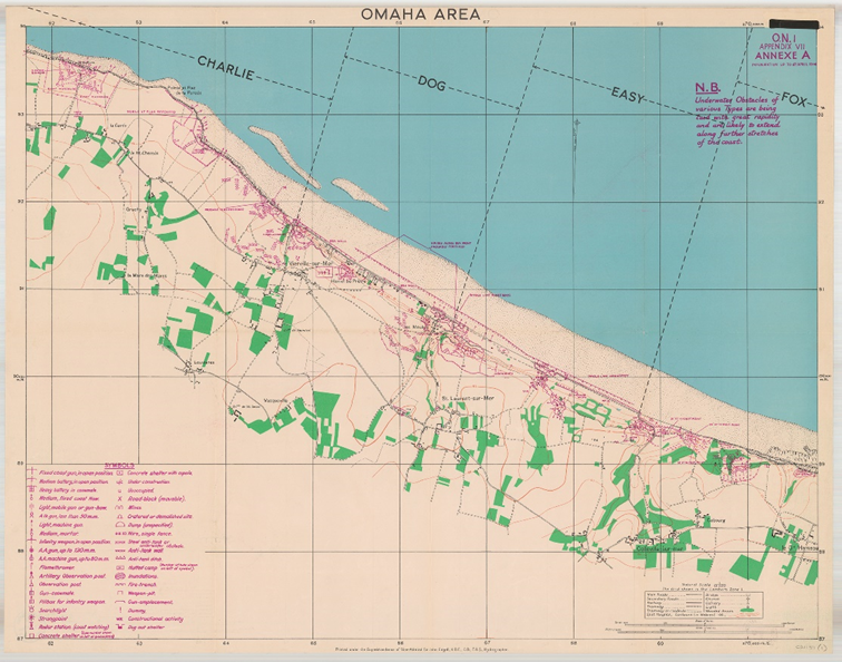
1:12,500 scale map of Omaha Beach
Six miles to the east Mulberry B was used by British troops at Arromanches on Gold Beach. A River Clyde paddleboat, called Aristocrat, served as company headquarters for Mulberry B.
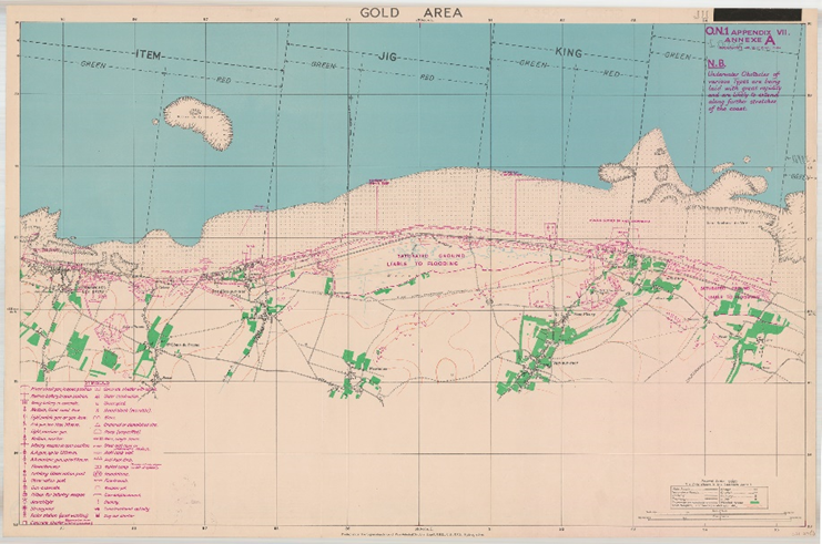
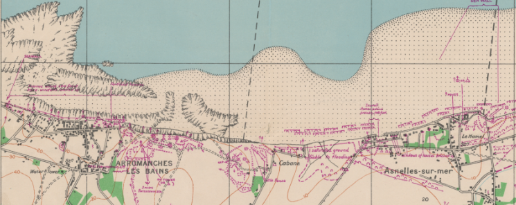
1:12,500 scale map of Gold Beach
Storm damage
A storm on 18th June damaged both Mulberries, with Mulberry A being damaged beyond repair. Damage to Mulberry B was repaired using whatever was salvageable from Mulberry A.
After the War
With building materials at a premium many of the girders from the Spuds were used to repair damaged and destroyed French bridges and some of the Phoenixes were re-floated and towed to Walcheren to repair war damage to the dykes.
In 1951 salvage work took place at Rigg Bay as some of the sunk prototypes from the sea trials were required as foundations of Larne Harbour in Northern Ireland.
Remains of components that did not make the journey across to France can still be found along England’s south coast.
Remaining Photographs
The following aerial photograph shows the Mont Fleury Battery,which was heavily bombed by 4th Group RAF Bomber Command during the aerial attack just before H-Hour. These aerial photographs were taken to check on the accuracy of the naval bombardment which preceded the landings.
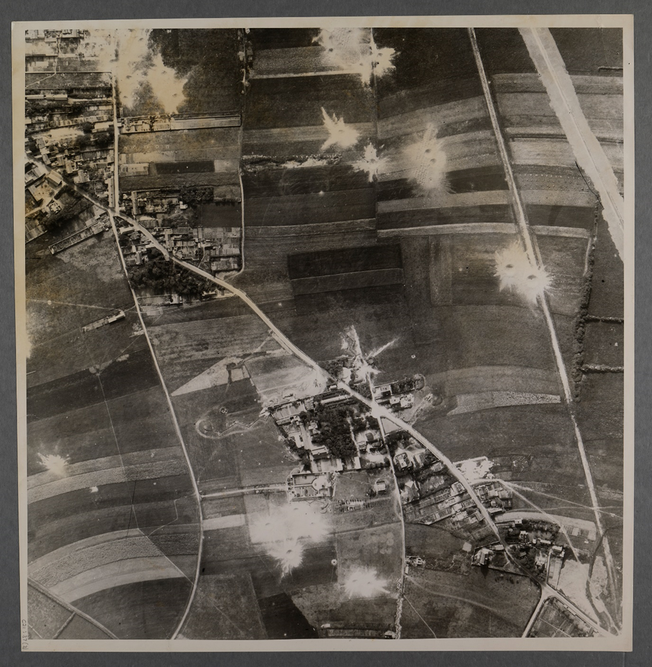
Mont Fleury. GSGS 4347/37/18SE/924863. 4015 of 140/212
Sword Beach features in the final aerial photographs.
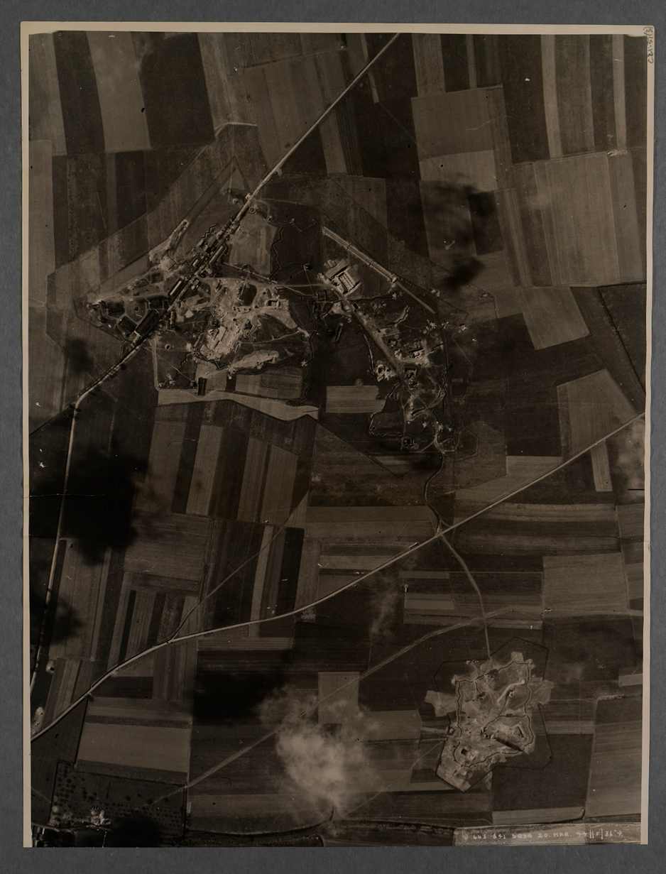
Douvres la Delivrande. GSGS 4347/40/18SW/0080. 3190 of J/665. 22 March 1944.
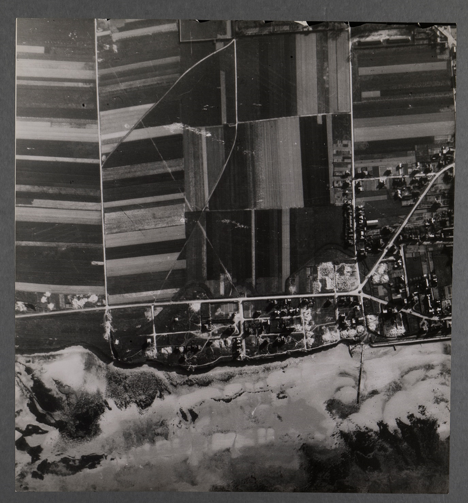
Petit Enfer (strongpoint). GSGS 4347/40/16NW/0483. 4004 of 16/32.
1:12,500 scale map of Juno Beach
Images used
Unless otherwise stated, the images used come from the Map Collections at the National Library of Scotland.