Hay's Map of Musselburgh and Environs

Zoom Into East Lothian

East Lothian, known as Haddingtonshire until 1921, sits to the east of Edinburgh. Local Government Reorganisation in 1975 saw it gain the coastal burgh of Musselburgh from neighbouring Midlothian. That town is now the largest in the county, closely followed by Dunbar and its county town of Haddington.  Its situation between Edinburgh and England has seen it witness some of Scotland’s most […]

Read More

Dalkeith by John Wood

Zoom into Midlothian

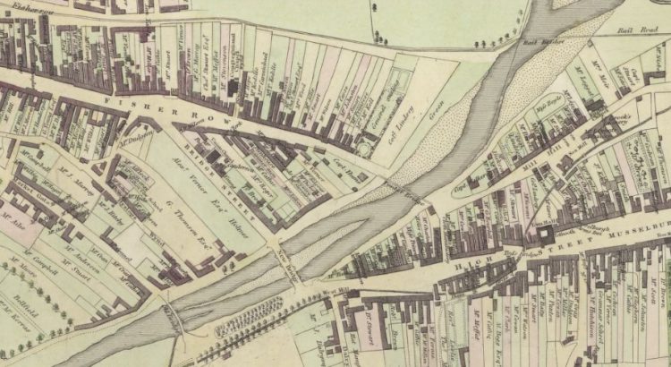
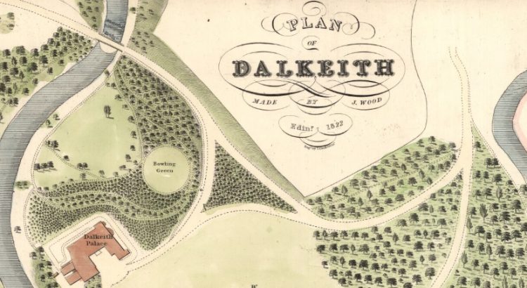
Midlothian is situated south of Edinburgh, and emerged as a county in the Middle Ages, also being known as Edinburghshire until 1921. The Local Government Reorganisation in 1975 saw it lose vast swathes of land to Edinburgh, East Lothian, West Lothian and the Scottish Borders. Most of the settlements lost at this time were relatively […]

Read More

Copyright in a Post Brexit World

On 13th October the National Library of Scotland hosted a Special Libraries Association event that saw Professor Charles Oppenheim give a talk titled ‘Copyright in a Post Brexit World’. After a brief introduction by John Coll, Head of Access at the Library, began by giving an overview of copyright: copyright basics what can be copyrighted how long […]

Read More

How you can use our maps

Our readers buy maps from us for a range of reasons. Some people want to hang the map on their living room wall. Others might use it in a planning application. We also get quite a number of readers using map images in books. Recently we had a member of Scottish Brewing Heritage contact us and […]

Read More

Crossing the River Lossie

Triangulation

The maps collection held by the National Library of Scotland is one of the finest in the world, and the foundation of the collection are the Ordnance Survey maps first produced in the mid-19th century. These maps, and those that followed, were made possible by a process called triangulation. Triangulation is a means of determining the location […]

Read More