East Lothian, known as Haddingtonshire until 1921, sits to the east of Edinburgh. Local Government Reorganisation in 1975 saw it gain the coastal burgh of Musselburgh from neighbouring Midlothian. That town is now the largest in the county, closely followed by Dunbar and its county town of Haddington.
Its situation between Edinburgh and England has seen it witness some of Scotland’s most important battles, such as the first Battle of Dunbar (1296), the Battle of Pinkie (1547), the second Battle of Dunbar (1650) and the Battle of Prestonpans (1745). During the Second World War it was considered a prime invasion spot for German forces, and was heavily fortified along coastal areas.
Well into the 20th century, the county had three strands of primary employment – agriculture, fishing and coal mining. Only the first of these retains a significant hold in the county, while the last went into an irreparable demise after the miners’ strike of 1984-85.
The county’s many miles of coastline has ensured its long-term popularity as a tourist destination. This was aided by the railway and its branch lines looping around the coast, taking in towns and villages such as Dunbar, North Berwick, Gullane, Aberlady and Port Seton, resulting in the erection of numerous large hotels. Whilst many of the hotels and swimming pools have been demolished or lost to fire, there is still a large tourist influx each year, many drawn by the county’s range of top class golf courses.
Where to find local collections:
John Gray Centre – Library, Museum & Archives, Haddington
https://www.johngraycentre.org/
Books – non fiction:
Samuel Smiles – Self Help
https://archive.org/details/selfhelpwithillu00smiliala
Book – fiction:
The Poems of William Dunbar
https://digital.nls.uk/early-gaelic-book-collections/archive/83054418
Film:
Dunbar – The A1 Resort
https://movingimage-onsite.nls.uk/film/1815?search_term=dunbar&search_join_type=AND&search_fuzzy=yes
Manuscript collection:
Letter about golf at Musselburgh (possibly in Manuscripts)
https://digital.nls.uk/golf-in-scotland/book/forbes-letter.html
Maps:
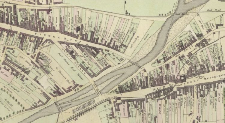
James Hay’s New Plan of Musselburgh and its Environs (1824)
https://maps.nls.uk/towns/rec/7504
John Wood’s Plan of Haddington and Nungate (1819)
View: Plan of Haddington and Nungate. – Town Plans by John Wood (nls.uk)
An e-resource:
Constitution of the West Salton Friendly Society
https://www.europeana.eu/en/item/17/_Resource_77504099
A business:
Directory of Musselburgh businesses, 1903
A person:
Black Agnes of Dunbar
Scran ::: Dunbar [Agnes Dunbar (Black Agnes) (c. 1312 – 1369)] (Library card required)
Art:
John Bellany
Scran ::: Bellany [John Bellany, C.B.E. (1942 – 2013)], Artist (Library card required)
A song or piece of music:
Go To Berwick Johnnie (Battle of Prestonpans)
Scran ::: Go To Berwick Johnnie (audio clip) (Library card required)
A ghost/mythical creature:
The ‘resurrection’ of Maggie Dickson
https://digital.nls.uk/broadsides/view/?id=16830
A castle or other historic building:
The Hutton drawings of Tantallon, Dirleton, Dunbar and Innerwick castles
https://digital.nls.uk/hutton-drawings/archive/97134421?mode=fullsize
Food:
Transfer of fruit trees between the Earl of Tweeddale’s properties at Pinkie and Yester
https://digital.nls.uk/recipes/themes/preserves/fruit-trees.html
Event:
A series of plans relating to the Battle of Prestonpans
https://maps.nls.uk/military/placename/Prestonpans
A photograph:
George McNeill of Tranent, Scotland’s greatest ever sprinter racing a horse at Meadowbank in 1971
https://www.scran.ac.uk/database/image.php?usi=000-000-121-944-R&cusi=000-000-121-944-C&scache=3slsaj856g&searchdb=scran (Library card required)
A number of photographs and videos related to Musselburgh’s Riding of the Marches:
https://www.scran.ac.uk/database/record.php?usi=005-000-005-896-C&searchdb=scran (Library card required)
Something about the county town:
The foundation of Haddington as a town is unclear, but it was of sufficient size in the early 12th century to be granted burgh status by King David I. Sitting 20 miles to the east of Edinburgh, it went on to play its part in a series of historical events.
The town suffered during the Seige of Haddington 1548-49, when Scottish and French troops attacked the Town, which was being held by the Earl of Shrewsbury’s troops. The town’s farmers were at the forefront of the Agricultural Revolution in the mid-18th century, and the creation of the New Mills Cloth Manufactory at the east end of the town, pre-dated the Industrial Revolution.
Large buildings came to dominate its architecture – a courthouse in 1833, and Corn Exchange in 1856, augmented the impressive St Mary’s Collegiate Church. But given Haddington’s size and importance it was, oddly, never part of the main railway line between Edinburgh and England, a branch line built in 1846, having to suffice.
In recent years a number of major businesses were attracted to the town, but many eventually closed. Mitsubishi, for example, opened in 1979, and closed 19 years later.
The town retains one of the finest examples of an almost extant medieval street plan, with even the back riggs being retained in places. In the 1950s and 1960s, whilst many Scottish towns were tearing down their dated buildings to replace them with modern alternatives, Haddington, driven by the town’s fiery town planner, Frank Tindall, retained its core of buildings. Tindall painted the central buildings in original pastel colours, added appropriate lighting and signage, and fought so hard to retain the town’s character that he almost lost his job when councillors approved the removal of the street cobbles.
Tindall’s protection of the town architecture sees it consistently considered as one of the most attractive towns in Scotland, whilst its relatively long distance from Edinburgh and the lack of a railway line to the capital (its branch line was removed in 1968, with passenger services having ended 19 years earlier) means that its small businesses continue to thrive.
Something about a village or small place:
The small village of Longniddry, sitting between Port Seton to the west, and Aberlady, was, at the end of the 18th century, ‘a long straggling conglomeration of rubble-walled, thatched or pantiled cot-houses, farm houses, barns and steadings’, was purchased by John Glassel in 1779. He proceeded to evict many of the tenants, and use the fertile land for farming. Unlike in other local land clearances, such as that at Whittingehame, the buildings were not replaced by a planned village. However, a remnant of the village did remain, and formed the foundation of today’s coastal town.
The village looks out onto the Firth of Forth, with a sandy beach known as the Longniddry Bents. To the east of the town is Gosford House, the seat of the Earl of Wemyss. The First World War led to much social change, with the building of Garden City housing for the return of veterans, and the creation of Scotland’s first Scottish Women’s Rural Institute, opened by the organisation’s founder, Catherine Blair of Hoprig.
Further reading:
Craig Statham, Lost East Lothian, Birlinn, 2011
https://search.nls.uk/permalink/f/sbbkgr/44NLS_ALMA21521396710004341
Frank Tindall, Memoirs and Confessions of a County Planning Officer
https://search.nls.uk/permalink/f/sbbkgr/44NLS_ALMA21504725320004341
John Kerr, The Golf Book of East Lothian, 1896
https://search.nls.uk/permalink/f/sbbkgr/44NLS_ALMA21546708900004341