The Library holds millions of items- books, journals, e-books, maps, music, moving images- and these can help individuals build both practical and emotional resilience in the face of the climate crisis. Be it a map showing the effects of coastal erosion in Scotland or an e-book on climate justice or a poem deepening our relationship with nature, the collections we hold can inspire people to take action in their own communities.
This blog is part of a short series highlighting how collection items can be used to tell the changing environmental stories of sites across Scotland. The examples are largely drawn from across our Collections.
More than 18,000 people live within the Cairngorms National Park. While rising temperatures most affect the sub-arctic mountain plateau endangering flora and fauna resident since the last ice age, changes to the mountain environment will also affect the many people who make their living from the land, whether farming or tourism.
The Cairngorms National Park is home to one quarter of Scotland’s native forest. It has one third of the UK’s land above 600metres, including four of the five highest mountains. It is also home to more than a quarter of the UK’s rare and endangered species.
CLIMATE IMPACT
Snow cover and climate change in the Cairngorms National Park: Summary Assessment by Mike Rivington, Mike Spencer, Alessandro Gimona, Rebekka Arts, Douglas Wardell-Johnson and Jonathan Ball, James Hutton Institute, 2019.This report was produced for the Cairngorms National Park Authority and clearly demonstrates the role snow plays within the region. It argues that snow cover is a defining characteristic of the Cairngorms National Park, underpinning the ecology, hydrology and economy, which are all dependent on how much snow falls, where, and how long it stays.
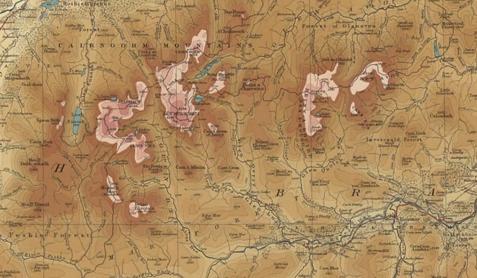
Bartholomew ‘Half Inch to the Mile’ Maps of Scotland, Sheet 16, Braemar and Blair Atholl, 1902. The gradient tints on this map give an impression of snow cover, but actually show the height of the mountains! It is important to use sources of information in conjunction with each other to create a true picture.
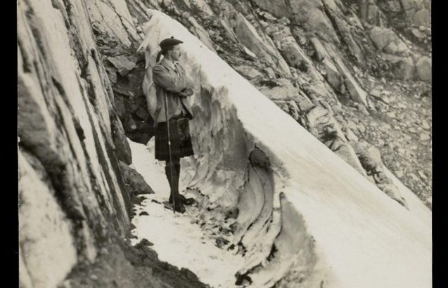
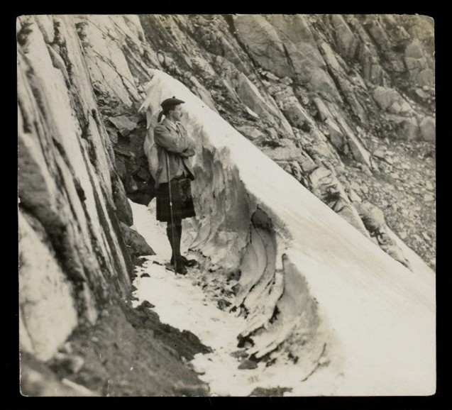
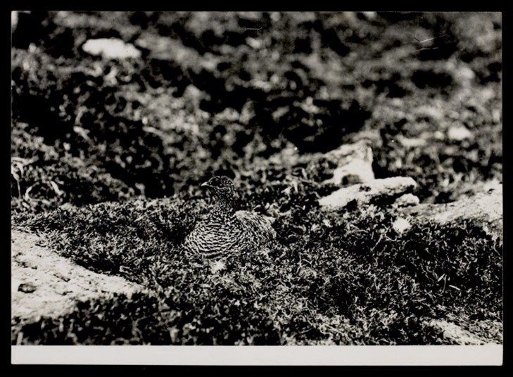
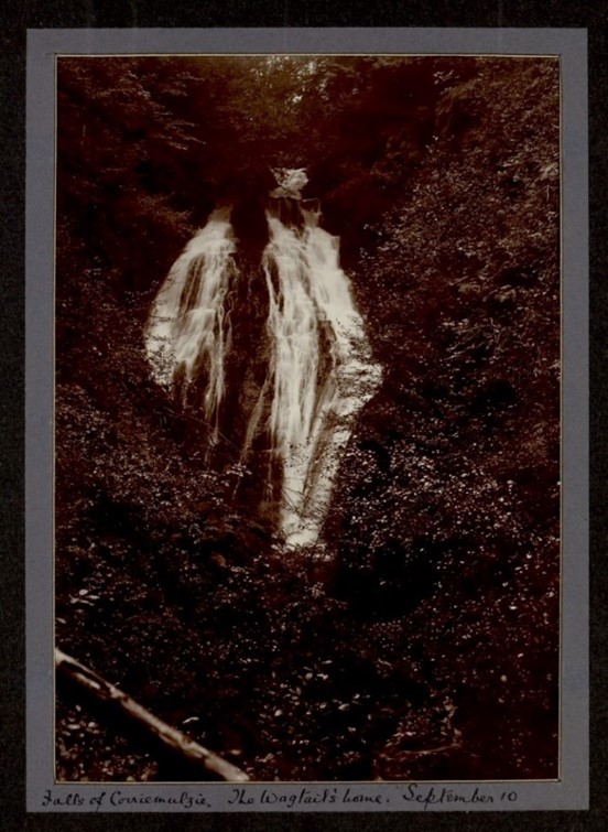
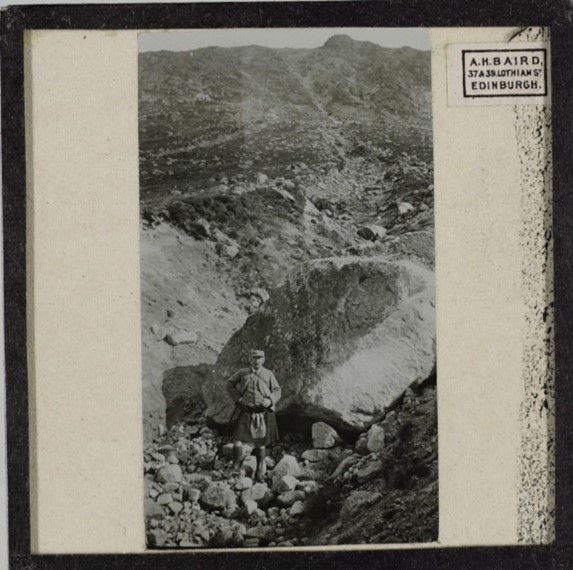
These photographs, taken from the papers of Seton Gordon, show the environment of the Cairngorms in 1905.
‘Ptarmigan on her nest 3500 feet up on the Cairngorms’ Papers of Seton Gordon [Library reference Acc.9990/5]
Schotland 1971, filmed by Jack P. Loorij. This film is amateur footage of a bird-watching trip to Scotland, including visits to the Cairngorms, capturing the fauna of the region fifty years ago.
LAND USE
Highlands and Islands Enterprise: Financial Management Review of Cairngorm Mountain, issued by Scottish Government, 2020.
Cairngorms landscape assessment by Turnbull Jeffery Partnership for Scottish Natural Heritage, 1996.
Mar Lodge Estate : Landscape Assessment by Turnbull Jeffery Partnership for Scottish Natural Heritage, 1996.
Mar Lodge : Woods and People : A History of the Mar Lodge Estate Woodlands by Fiona J. Watson and Mairi Stewart, 2004. Available to read in the Library.
Correspondence of Don and Bridget MacCaskill on environmental issues and relating to their publications. 1973-2000, and some undated. Available to view in the Library [Library reference: Acc.13709/1] The MacCaskills wrote several books, illustrated with Don’s photographs; they provide an interesting comparison with today’s environments in the area, but their correspondence also gives further insight into their views and environmentalism.
The Story of Invereshie and Inshriach National Nature Reserve by Scottish Natural Heritage, 2009.
The Reserve Plan for Abernethy – Dell Woods National Nature Reserve 2009-2015 by Scottish Natural Heritage. 2008.
Ordnance Survey, 25 inch to the mile, Inverness-shire – Mainland sheet LXXIII.11 (Alvie, & Duthil & Rothiemurchus), 1873. The changing forest landscapes can be tracked through Ordnance Survey mapping.
Land Utilisation Survey Scotland, 1931-1935, Sheet 43 Kingussie. The key clearly shows much of the mountain area as rough pasture.
TRANSPORT
Clim-ATIC : rural communities adapting to the impacts of climate change Cairngorms National Park Electric Vehicle Project 09-11. Grantown-on-Spey : Cairngorms National Park, [2010?] Available to read in the Library.
The Road from Dalnacardoch to Aviemore, Plate 22 from the ‘Survey of the roads of North Britain or Scotland’ by G. Taylor & A. Skinner, 1776. The valley has long been a valuable transport route, but links are made vulnerable through extreme weather and flooding events.
ENERGY
Hydropower Appraisal in Cairngorms: Final report, prepared by Nick Forrest, babyHydro, for the Association of Cairngorms Communities, 2016.
Towards Sustainable Livelihoods and Ecosystems in Mountain Regions by Vishwambhar Prasad Sati, 2014. Library membership and log-in required to read online.
INDUSTRY
Climate change and Scottish agriculture. Farmers’ guide : reducing greenhouse gas emissions from farms by Cairngorms National Park Authority, [2010?] Available to read in the Library.
Spey Valley – Ski Valley, film directed by James Handsley for the Highlands and Islands Development Board, 1970. Tourism is a major industry in the area but often comes into conflict with the desire to manage the land for wildlife and conservation. This film of the Cairngorms Winter Festival of 1970 shows visitors to the area, and the snow-cover that year.