In the run-up to the 26th United Nations Climate Change Conference, Glasgow, 31 October – 12 November 2021 (COP26), the National Galleries of Scotland and National Library of Scotland are inviting you to respond creatively to works from the national collections to visualise how Scotland has been and will continue to be impacted by climate change, unless decisive action is taken.
Teams in both organisations have collaborated to select objects and artworks that depict five landscapes across Scotland. Each represents a key theme of climate change which we are experiencing in Scotland as well as globally. These include sea level rise, biodiversity, land use and agriculture, low carbon energy production and transport. All areas selected are already being impacted by a multitude of interwoven climate change factors, affecting communities and environments.
The eyes of the world will turn to Scotland as COP26 comes to Glasgow in November 2021. We are asking you to get creative and share your vision of a changing Scotland.
How to get involved
- Take a look at the paintings, artworks, maps and films we have selected depicting the Outer Hebrides, Fife, the Clyde Basin, the Cairngorms and Edinburgh.
- Think about how these places might have changed since the depictions were made or how they might change in the future.
- Let your creative juices flow! You might respond by taking a photograph, writing a poem or short story, creating a drawing, painting or computer graphic or recording a piece of audio.
- Send them to our friends at the National Galleries of Scotland by 23:59 on Friday 12th November using this form Preserving pasts | Imagining futures (typeform.com)
- Please note that we can only accept virtual submissions at this time due to ongoing COVID restrictions.
- The project aims to start a conversation about climate change, so there is no prize. However, we will publish as many of the responses as we can on our websites and social media channels with full credit during COP 26 in November.
- By sending your work to the address above, you permit the National Galleries of Scotland and National Library of Scotland to share your submission on their respective websites, external marketing communication, third party social media channels and on site without payment.
- By sending your work to the address above you represent and warrant that you are the sole author and owner of the work and that you are entitled to grant the National Galleries of Scotland and the National Library of Scotland the rights granted here and that the consent of no other person is required in order for these organisations to use the work you submit. You warrant that your work does not infringe upon copyright, moral rights or any other right of any other person.
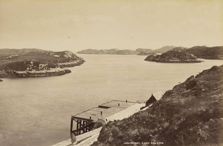
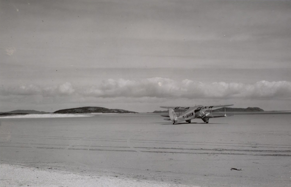
OUTER HEBRIDES
How will coastal communities adapt to sea level rise, and what will these landscapes look like in the future?
Approximately 1,200 people live on the island of Benbecula, many in coastal locations. They depend upon the north-south spinal road which connects to North and South Uist by causeways. These connections and many of the coastal settlements are at risk from inundation both from sea level rise and more extreme weather events which can cause further coastal damage. Transport links which are crucial for the community such as the airfield would also be affected. The highest point is only 124 metres, with most of the island only 20 metres elevation. With a maritime climate with a low annual range, any warming will have a significant impact on the flora, fauna and farming on the island.
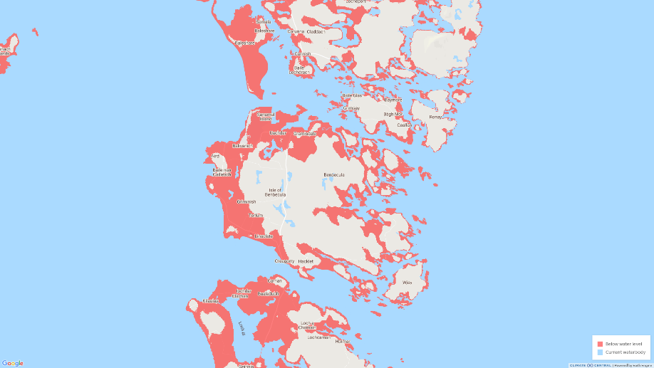
Land projected to be below annual flood level in 2050
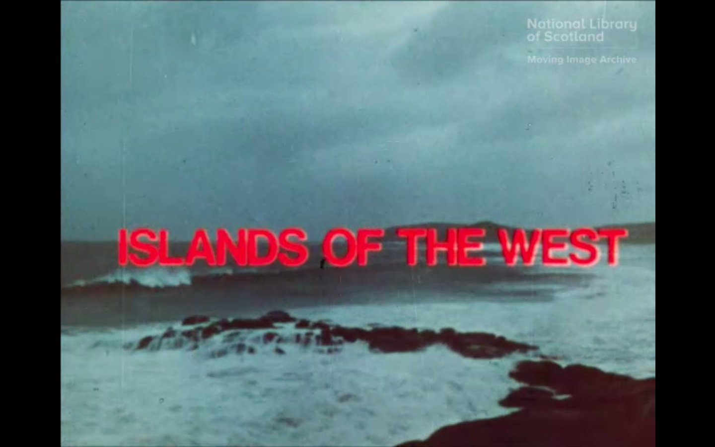
https://movingimage.nls.uk/film/2692

Benbecula by William Scott (GMA 852).
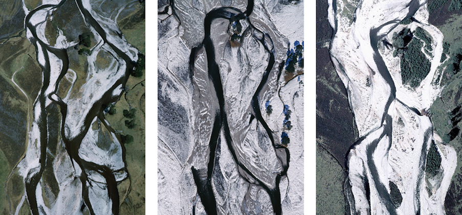
CAIRNGORMS
How do you see these mountainous landscapes in the future, with woodlands and peatlands restored?
While rising temperatures mostly affect the sub-arctic mountain plateau endangering flora and fauna resident since the last ice age, changes to the mountain environment will also affect the many people who make their living from the land. The Cairngorms National Park has seen a decline in the snow cover of its hills; this decline can be linked with global heating and will have an impact on the local ecology and hydrology, as well as local communities whether through farming, gamekeeping or tourism. The national park has already taken steps to adapt to climate change, including identifying the key role it has to play in tackling climate change through nature-based solutions such as peatland restoration and woodland creation.
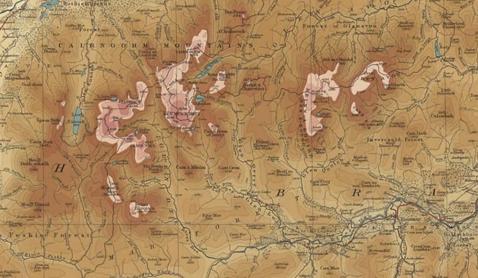
https://maps.nls.uk/view/97130770
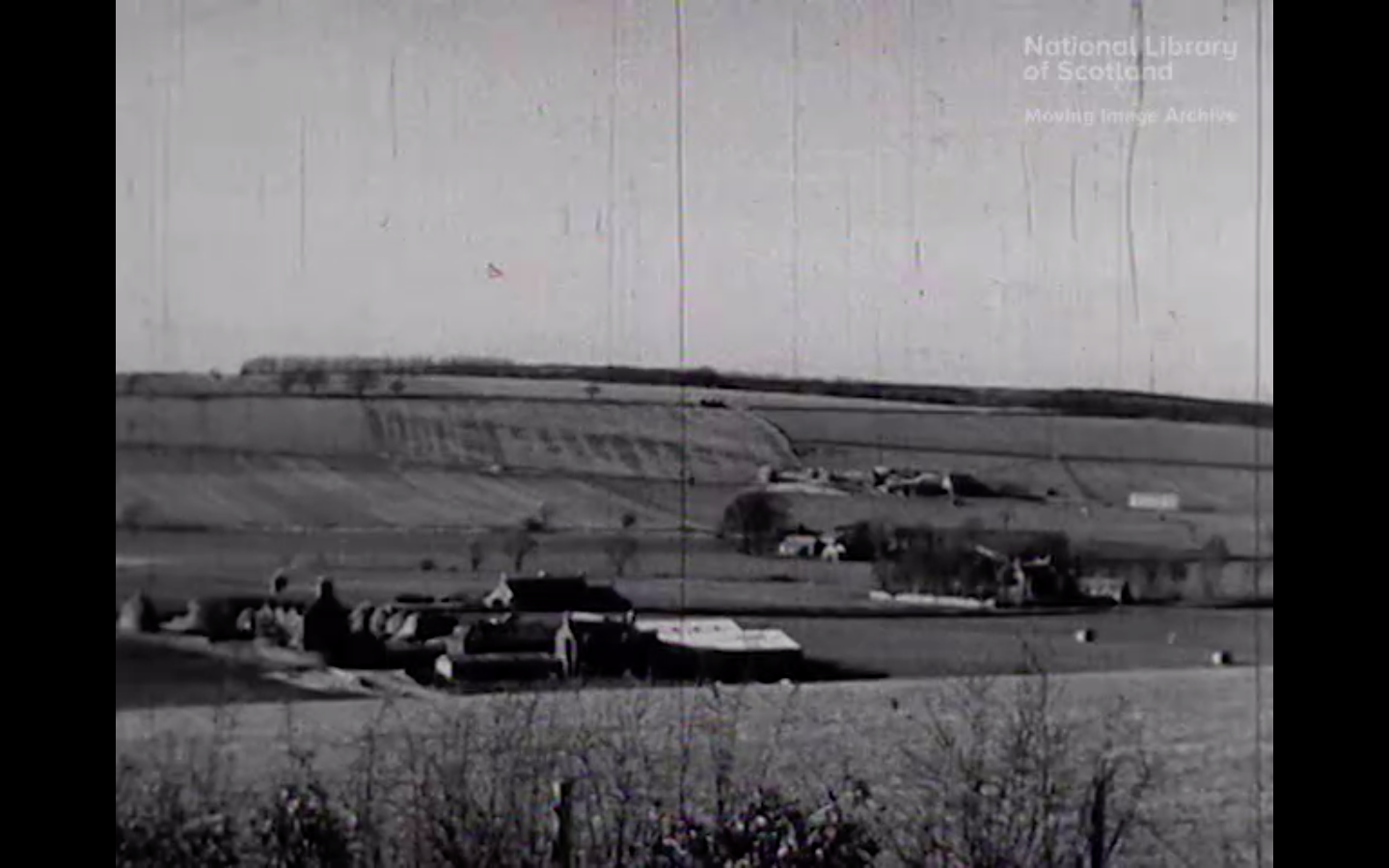
CLYDE RIVER BASIN
How do you imagine the post-industrial landscapes changing, where do renewable energy technologies fit in the picture?
Running from the Lanarkshire Hills through Glasgow city to the shallow estuary, the River Clyde has a diverse history associated with shipbuilding and heavy industries such as iron and steel works. More recent regeneration projects along the length of the river have been transforming these sites and shifting the industrial landscape to support healthier lifestyles and supporting the environment. Reducing the energy we use and decarbonising our urban areas by moving away from fossil fuels is an important strand to Scotland climate change plans. Renewable energy projects such as the large-scale water source heat pump scheme which has been installed at Queens Quay ands Scotland’s largest windfarm at Whitelee are examples of this.
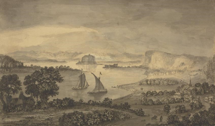
https://www.nationalgalleries.org/art-and-artists/29089/dumbarton-castle-east
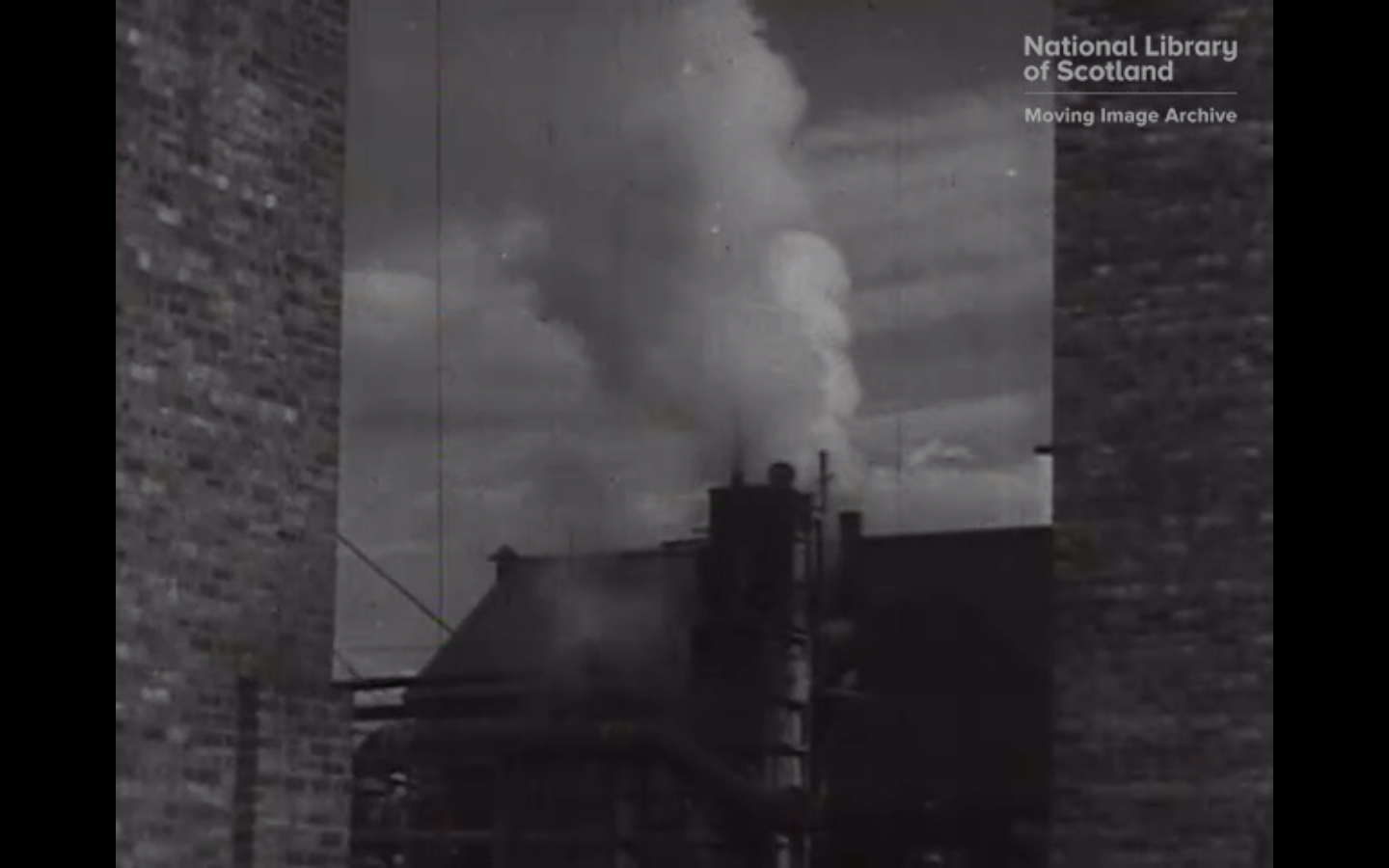
https://movingimage.nls.uk/film/1694
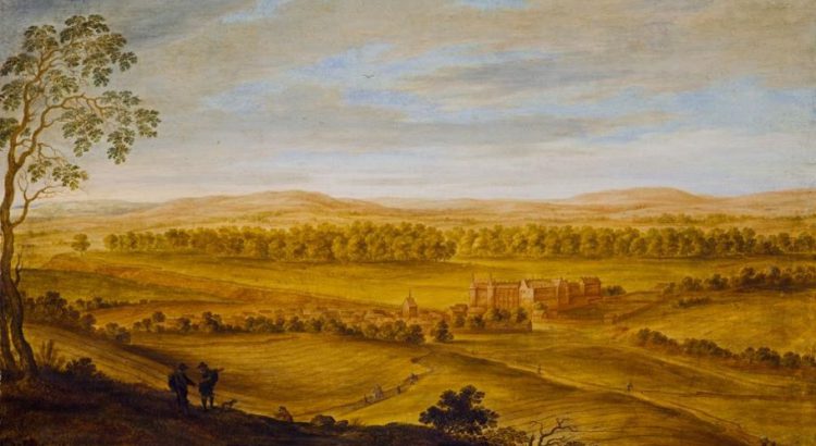
FIFE
Imagine the landscapes changing over time to protect our soils, grasslands, flora and fauna – what will it look like to you?
The Fife coast is popular with tourists for its scenic, historic fishing villages, but is also home to industry, and rich agricultural land. Our landscapes are part of Scotland’s natural capital which help support our rural communities and economies as well as our food production. The way land is used in sustainable food production and agriculture can impact climate change while also protecting our vital soils and grasslands. The target is to maintain high quality food production and environmental standards while creating more sustainable, healthier, local food systems.
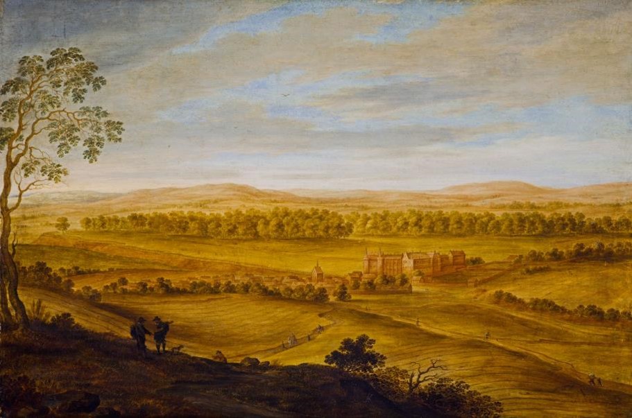
https://www.nationalgalleries.org/art-and-artists/2402/falkland-palace-and-howe-fife
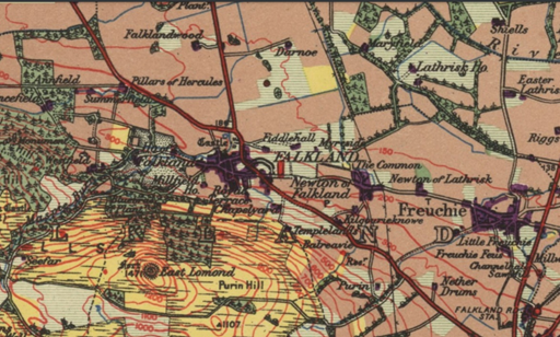
https://maps.nls.uk/view/91173368
(Brown is arable land, yellow, pasture)
https://movingimage.nls.uk/film/0885
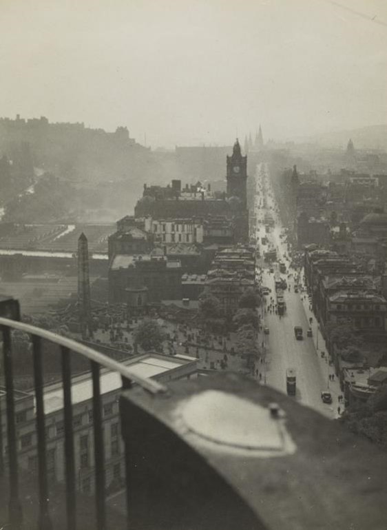
EDINBURGH
How will the city look in future years, with greener spaces, more active travel and less pollution?
As the capital city of Scotland, Edinburgh is a hub for people visiting nationally and internationally. Transport accounts for 35.6% of Scotland’s emissions (2018 data); from daily travel, aviation, maritime, as well as heavy goods. Thousands of people commute in and out of the city every day, many by car. Targets have been set to stop the sale of petrol and diesel cars by 2032, while Edinburgh is transforming how we approach inner-city travel to encourage more sustainable low carbon and active travel to support healthier lifestyles and reduce pollution.
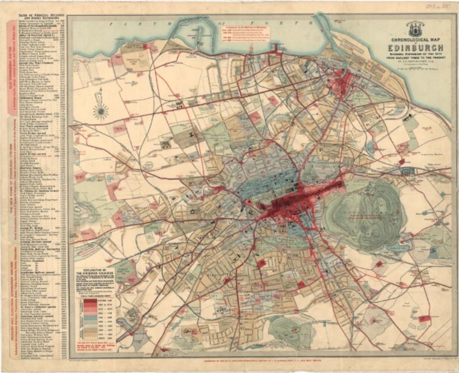
https://maps.nls.uk/towns/rec/412