
In August 1932 a new Scottish literary star was born when the novel “Sunset Song” by Lewis Grassic Gibbon was published. An instant critical and commercial success it was reprinted multiple times that year in the UK as well as being published in North America and quickly translated into other European languages. Gibbon’s novel tells […]
Politics, publicity and potatoes: Scotland’s tattie howking films
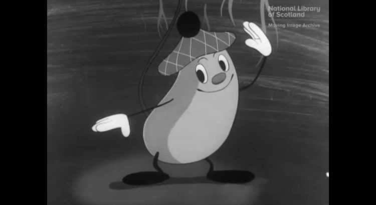
Dr Emily Munro, National Library of Scotland Moving Image Archive Watch our video ‘Tattie Howkin’ Today commercial potato crops are usually gathered by machines but, in the past, the job of lifting potatoes from the soil was done by hand. The Scottish potato harvest once employed thousands of men and women (often migrant workers from […]

#LetterstotheLibrary
The Library of The Royal College of Surgeons of Edinburgh has been in existence since the late 17th-century. Our staff of three look after the clinical information needs of around 27,000 members in over 100 countries. In addition, our archive serves as the College’s “memory”, conserving manuscripts from throughout our 515-year history and answering enquiries […]
#LetterstotheLibrary
Dear National Library, It’s Lois here. In case you’ve forgotten me, I work in the General Reading Room and can occasionally be found in the Special Collections Reading Room too. Right now, I’m staying with family in the north east of England, and doing various pieces of Library work from home, including answering online enquiries […]
#LetterstotheLibrary
Week seven of university online and cabin fever is on the up. I’m a full time Information and Library Science student at the University of Strathclyde. Strathclyde shut down and moved all teaching online one week before the official government lockdown started. Now, at the end of the semester with no more classes but many […]
Delivering a bestseller: Culpeper and midwifery
Today we’re celebrating Midwifery Day with a look at its earliest bestseller. Just about 200 years ago, this book was published: Aristotle and midwifery – what’s that all about? And who was Culpeper? Let me take you right back to the 17th century where this story begins. At that time and well beyond, midwifery was […]
Volunteers working in Collections Audit
Volunteering in the Collections auditing department at National Library of Scotland: a testimony By Imogen Fitzpatrick and Jeevan Sanghera Imogen and Jeevan’s time volunteering in the Collections auditing department has been a fun and rewarding experience. We have gained valuable insights into the heritage and conservation sector, providing us with possible career pathways and industry […]
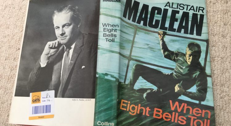
Lockdown reading: Alistair MacLean’s “When eight bells toll”
In order to build and promote the Library’s collections you need to have at least some familiarity with them which means doing a bit of reading. Sadly contrary to what some might think National Library of Scotland staff don’t spend their working days reading the collections, we have too many other things to do. So […]

#LetterstotheLibrary
Hi all, My name is Niamh, I’m the archivist managing Donegal County Archives, the local authority archive service of Donegal County Council. For those of you who don’t know, Donegal is a large, mainly rural, county in the far north of Ireland. It is in the Republic of Ireland, though we share a border with […]
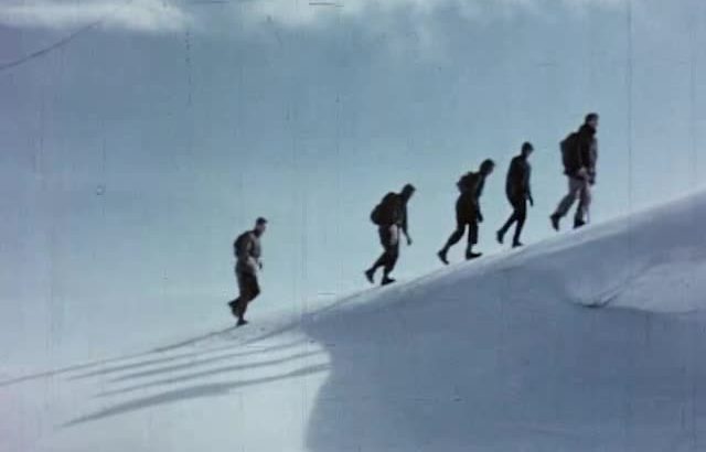
Escape to the mountains (on film)
At a time when libraries and cinemas are physically closed, and millions of us around the world are staying at home, the International Federation of Film Archives (FIAF) is encouraging people to explore and enjoy the free film heritage that institutions like the National Library of Scotland provide. With tens of thousands of films to […]