In August 1932 a new Scottish literary star was born when the novel “Sunset Song” by Lewis Grassic Gibbon was published. An instant critical and commercial success it was reprinted multiple times that year in the UK as well as being published in North America and quickly translated into other European languages. Gibbon’s novel tells […]
Category: 20th-century items

Politics, publicity and potatoes: Scotland’s tattie howking films
Dr Emily Munro, National Library of Scotland Moving Image Archive Watch our video ‘Tattie Howkin’ Today commercial potato crops are usually gathered by machines but, in the past, the job of lifting potatoes from the soil was done by hand. The Scottish potato harvest once employed thousands of men and women (often migrant workers from […]
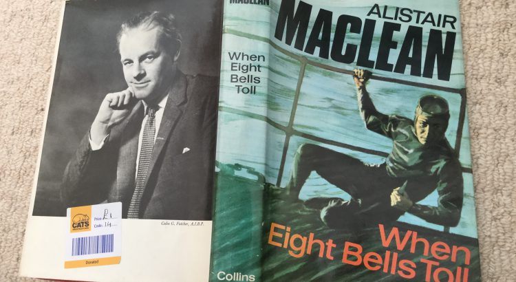
Lockdown reading: Alistair MacLean’s “When eight bells toll”
In order to build and promote the Library’s collections you need to have at least some familiarity with them which means doing a bit of reading. Sadly contrary to what some might think National Library of Scotland staff don’t spend their working days reading the collections, we have too many other things to do. So […]
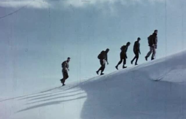
Escape to the mountains (on film)
At a time when libraries and cinemas are physically closed, and millions of us around the world are staying at home, the International Federation of Film Archives (FIAF) is encouraging people to explore and enjoy the free film heritage that institutions like the National Library of Scotland provide. With tens of thousands of films to […]
Sunset Song is now available to read on our website
We have just made available all the books published by James Leslie Mitchell (1901-1935) during his lifetime on our website. Included are the three novels he published under the pseudonym Lewis Grassic Gibbon namely “Sunset Song” (1932); “Cloud Howe” (1933) and “Grey Granite” (1934) which are collectively known as “A Scots Quair”. http://digital.nls.uk/lewis-grassic-gibbon-books You can […]
Geocoding the Stevenson Maps and Plans of Scotland
Written by Rachel Dishington, Collaborative Doctoral Partnership PhD student at the University of Edinburgh The Stevenson family of engineers worked extensively throughout Scotland during the nineteenth and early twentieth centuries. Their work focused primarily on coastal engineering projects, particularly harbours including at Peterhead as shown below. Most famously, they were responsible for the construction and […]
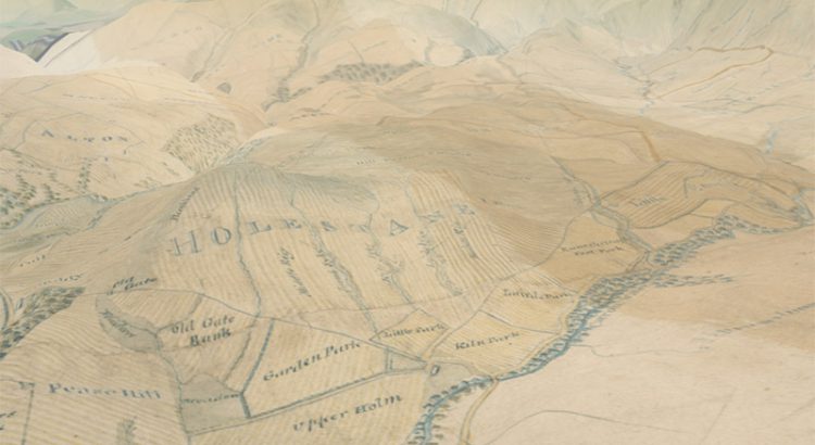
Scotland from above – our 3D map viewer with new vertical exaggeration
In early 2016 we launched our 3D map viewer, allowing our georeferenced maps to be viewed from a bird’s-eye perspective. This combines our historic map layers with elevation data, so that they can be draped and visualised across a real landscape in three dimensions. Whilst the viewer has been popular, we have recently added a […]
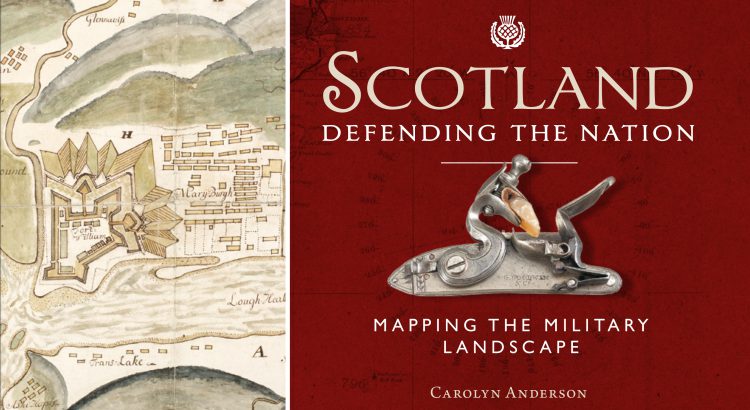
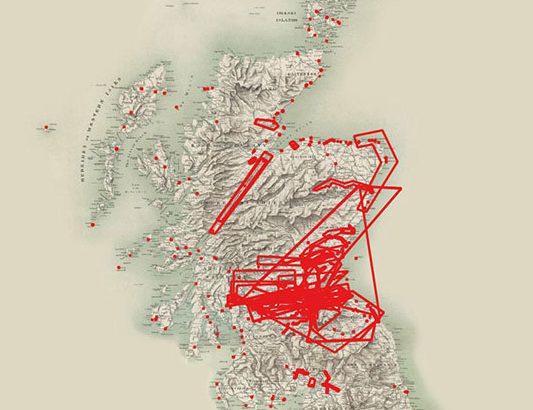
Scotland: Defending the Nation – Mapping the Military Landscape
Some of the most detailed and alarming military maps of Scotland were made by external aggressors, planning attack or invasion. Here we look at maps made by four of these countries: French charts, 1800s In the early 18th century, when Napoleonic France made preparations for an invasion of Great Britain, the best available charts of […]