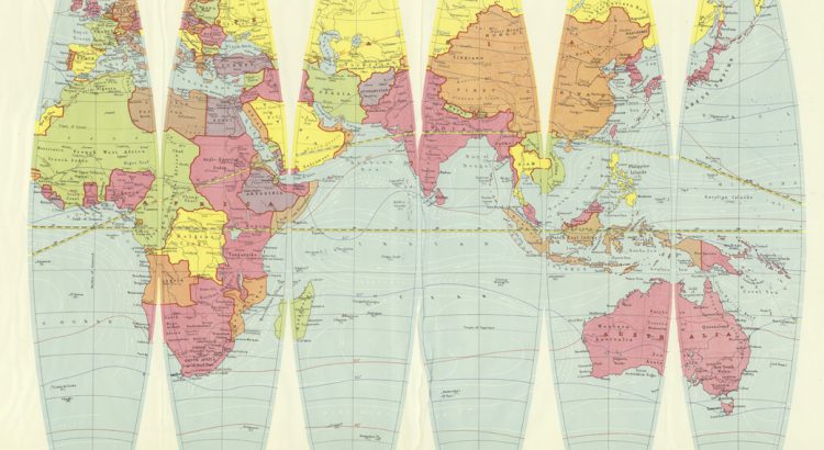
Examine a terrestrial globe and what do you see? A fascinating model of how we view the world? A historical snapshot of the various landmasses and water features we have encountered? Or are globes a political narrative reflecting the creator’s point of view?
Setting up a web-mapping interface for the Stevenson Collection
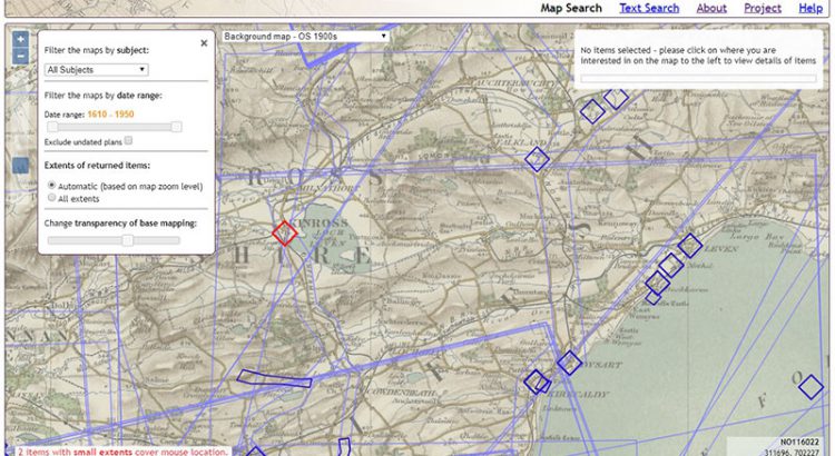
Written by Rachel Dishington, Collaborative Doctoral Partnership PhD student at the University of Edinburgh, and Chris Fleet, Map Curator. In a previous blog post, we described in detail the process of geocoding the Library’s Stevenson maps and plans of Scotland. This process generated a file that linked metadata describing over 2000 maps and plans to […]
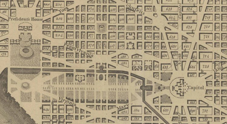
Map of the Month: Planning a Capital City
Planning of a New “Federal City” After the success of the American Revolution, Americans were faced with a decision: where to build their capital. In a foreshadowing of future conflict, the main debate was whether this monumental city should be built in the North of the South. The South was unhappy with economic decisions after […]
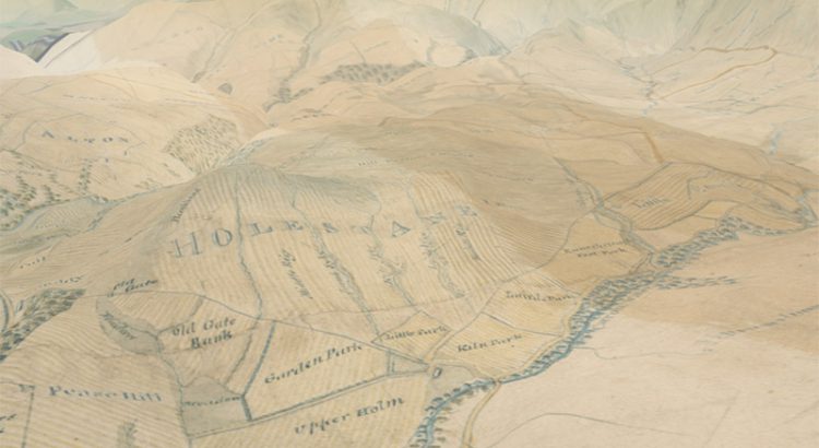
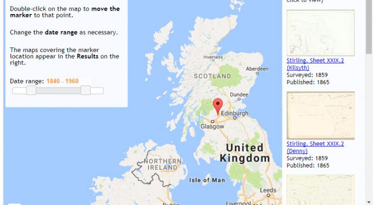
Geocoding the Stevenson Maps and Plans of Scotland
Written by Rachel Dishington, Collaborative Doctoral Partnership PhD student at the University of Edinburgh The Stevenson family of engineers worked extensively throughout Scotland during the nineteenth and early twentieth centuries. Their work focused primarily on coastal engineering projects, particularly harbours including at Peterhead as shown below. Most famously, they were responsible for the construction and […]
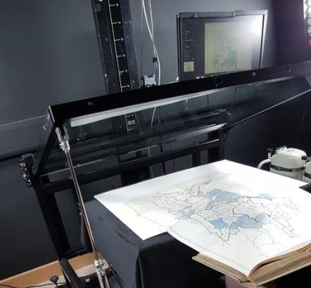
Digitising the Library’s Maps
By: Gabi Migdalska (Specialist Digital Production Operator ) and Rosemary Hall (Maps Assistant) The National Library of Scotland holds well over 1.5 million maps and counting. The collection ranges from manuscripts to single fold-out maps in books to Ordnance Survey series containing 1000s of sheets. Holding such extensive collections puts the Library in a unique […]
Scotland from above – our 3D map viewer with new vertical exaggeration
In early 2016 we launched our 3D map viewer, allowing our georeferenced maps to be viewed from a bird’s-eye perspective. This combines our historic map layers with elevation data, so that they can be draped and visualised across a real landscape in three dimensions. Whilst the viewer has been popular, we have recently added a […]
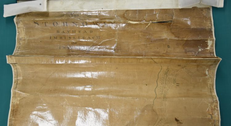
Conserving the map of Stornoway by James Chapman, ca. 1800
The Stornoway map is one of a group belonging to Stornoway Public Library, which were sent to the Library in 2017 for digitisation. However, the map could not initially be digitised due to its poor condition. It had been heavily conserved in the past, leaving the paper stained, skinned and distorted, with many large cracks, […]
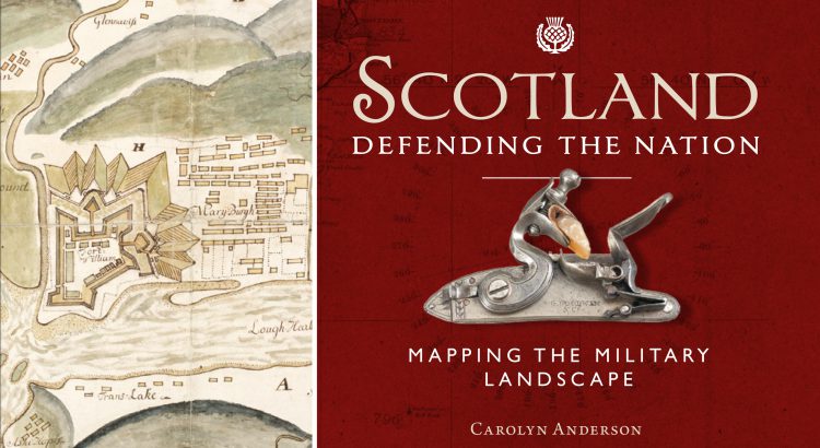
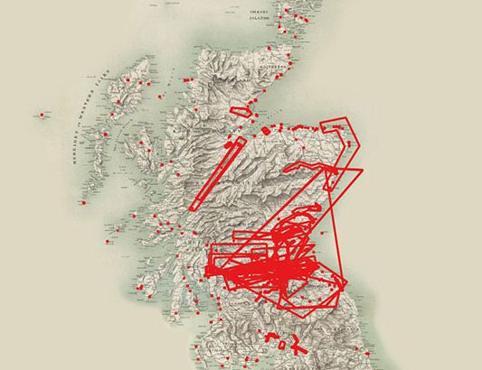
Scotland: Defending the Nation – Mapping the Military Landscape
Some of the most detailed and alarming military maps of Scotland were made by external aggressors, planning attack or invasion. Here we look at maps made by four of these countries: French charts, 1800s In the early 18th century, when Napoleonic France made preparations for an invasion of Great Britain, the best available charts of […]
Using the Library’s open-source map viewers
Are you interested in creating a web-mapping viewer or application? Do any of the Library’s web-mapping applications have functions or interfaces you need? If the answer to these questions is yes, then you may be interested to know that the code behind all of our web-mapping applications is available for free and easy onward use […]
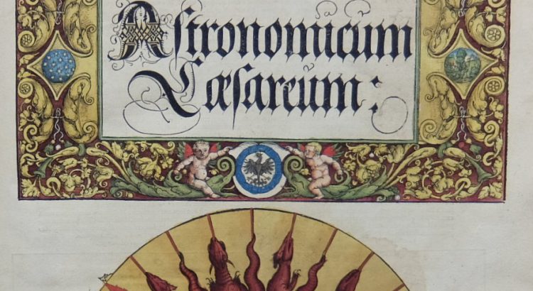
Astronomicum Caesareum
Peter Apian’s Astronomicum Caesareum (Ingolstadt, 1540) is one of the finest printed books in the National Library of Scotland, hand coloured throughout and featuring ingenious and beautiful volvelles. Apian, humanist mathematician and astronomer and born Bienewitz in Leisnig, Saxony (Biene is German for bee, hence the Latinizing of his name to Apian), was the son […]