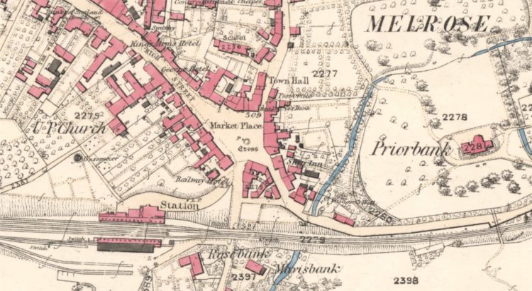
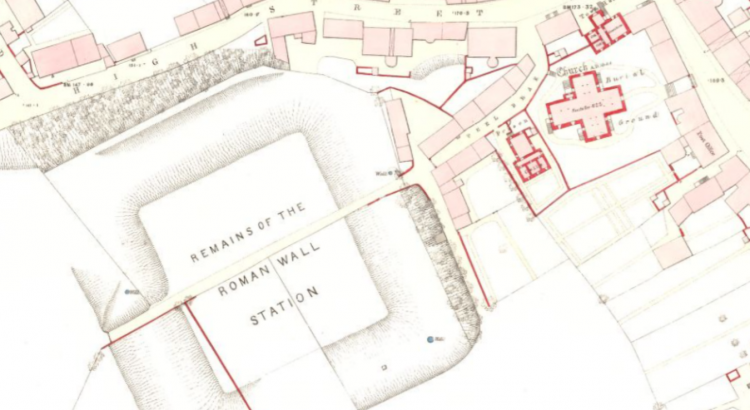
Collated by Charlotte James Robertson. The Scottish Borders, which are sometimes simply called The Borders, stretch from the Pentland Hills, which mark their boundary with the Lothians, to the River Tweed at the border with England. As an area of exceptional beauty the Scottish Borders have inspired writers like Sir Walter Scott and John Buchan. They are also home to several […]
Category: 19th-century items
Zoom into East Dunbartonshire
Collated by Veronica Bell. East Dunbartonshire was formed in 1996, from the former Bearsden and Milngavie district, and most of the former Strathkelvin district. Situated to the north of Glasgow, it contains many of the city’s suburbs and commuter towns. Its county town of Kirkintilloch has a rich industrial heritage, partly due to its rail links and […]
Zoom Into East Lothian
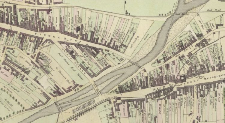
East Lothian, known as Haddingtonshire until 1921, sits to the east of Edinburgh. Local Government Reorganisation in 1975 saw it gain the coastal burgh of Musselburgh from neighbouring Midlothian. That town is now the largest in the county, closely followed by Dunbar and its county town of Haddington. Its situation between Edinburgh and England has seen it witness some of Scotland’s most […]

Zoom into Moray
Collated by Moray Teale. Moray is situated in the north-east of Scotland and borders the Aberdeenshire and Highland council areas. Until 1996 Moray was also part of the Grampian Region. Moray has a varied landscape from the Moray Firth and largely flat coastline, to the hilly interior and several lochs. The River Spey runs through much of the area, which is famous for its whiskies and contains more […]
Zoom into Stirling
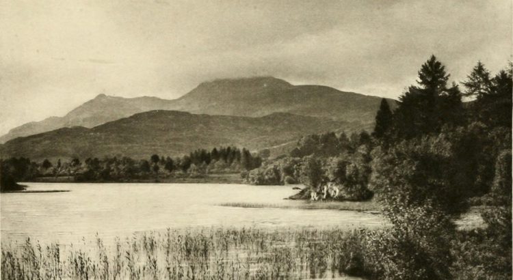
Collated by Jamie McIntosh. The Stirling authority area is at the heart of Scotland and spans the traditional boundary between the lowlands and highlands. To the west of the region sit the Campsie Fells and the Fintry Hills, which eventually give way to Loch Lomond. The boundary of the authority runs up the east side of the loch, taking in the Trossachs and Ben Lomond. The northern area of the authority is generally […]
Zoom into West Dunbartonshire
Collated by: Veronica Bell. Situated between Glasgow to the west and Loch Lomond to the north, West Dunbartonshire is a county centred around three main towns: Dumbarton, Clydebank, and the Vale of Leven district. It is historically significant – the town of Dumbarton was the capital of the ancient kingdom of Strathclyde, and its famous […]
Curators’ Favourites: Robert Louis Stevenson’s The Amateur Emigrant
The choice: Robert Louis Stevenson – The Amateur Emigrant (Edinburgh, 1895) Chosen by: Anette Hagan, Rare Books Curator (Early Printed Collections to 1700) Read or download this book from our Digital Gallery. Welcome to the latest of our new fortnightly series where we introduce you to some favourites from our collections for you to enjoy reading, all freely available online. This […]
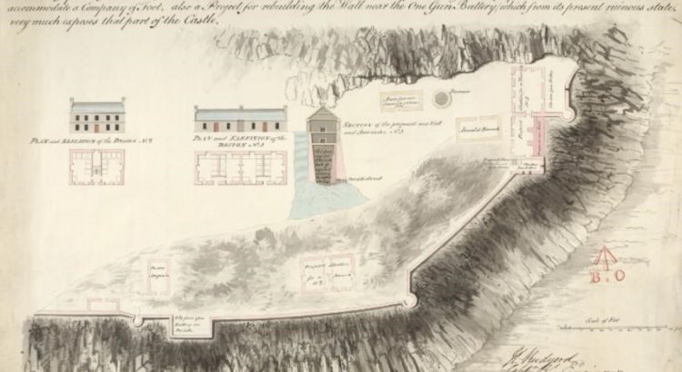
Zoom into Argyll and Bute
Collated by Veronica Bell. Argyll and Bute is the second largest administrative area of any Scottish council, with its varied geography consisting of a heavily indented coastline, numerous islands, and a hilly mainland encompassing hundreds of lochs. There is much for the historian to discover, from prehistoric monuments such as Kilmartin, to early Christian sites […]
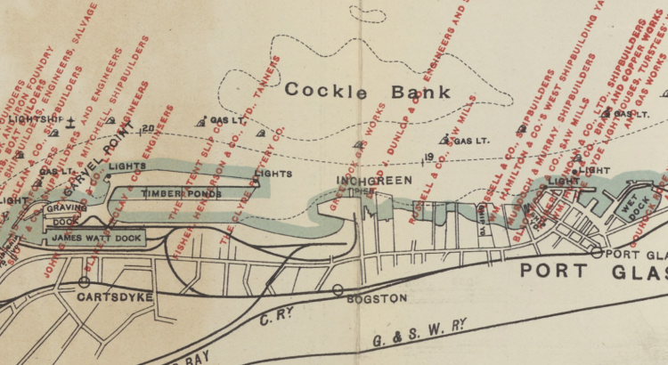
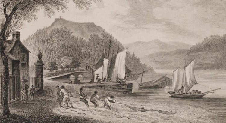
Zoom into Inverclyde
Part of the historic county of Renfrewshire, Inverclyde is situated in the crook of the upper Firth of Clyde as it bends east toward Glasgow. Its largest towns, Greenock and Port Glasgow, were historic centres of shipbuilding. From the eighteenth century they were key ports for the British trade in goods from overseas, including commodities, […]
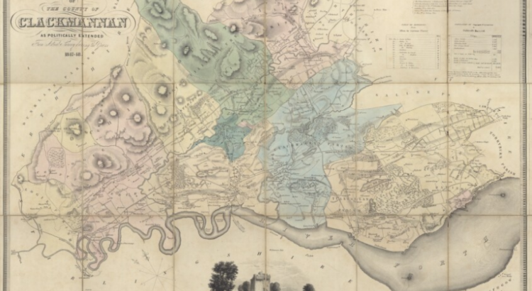
Zoom into Clackmannanshire
Collated by Charlotte James Robertson. This time in our ‘Zoom into…’ series the spotlight is on Clackmannanshire. Affectionately known as ‘The Wee County’ it is mainland Scotland’s smallest council area by population. Clackmannanshire borders the council areas of Stirling, Fife, and Perth & Kinross. The town of Clackmannan was the county town up until 1822 when Alloa became the main administrative centre. […]