The unitary region of Dumfries and Galloway was created in 1975, following a reorganisation of Local Government in Scotland. It brought together the historic counties of Dumfriesshire, Wigtownshire and the Stewartry of Kirkcudbright. Though now part of Scotland, the region was once part of the ancient Northern Brittonic Kingdom of Rheged and later the Kingdoms […]
Category: Film
Zoom into Dundee City
Collated by Lorna Black. Dundee is the fourth largest city in Scotland and lies on the north bank of the River Tay. Dundee is famous for three Js: Jute, Jam and Journalism. During the peak of jute production the city was nicknamed Juteolopis. It is also known for the Tay Bridge Disaster and RSS Discovery. […]
Zoom Into North Ayrshire
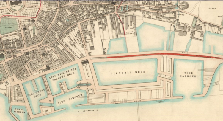
Collated by Emma Boyd North Ayrshire is a council area in the south-west of Scotland. Set along the coast of the Firth of Clyde and with a population of over 135,000 at the last census; it is the most populous of the three Ayrshire regions. The area was formed in 1996 from the former Cunninghame district, and includes the Isle of […]
Zoom Into East Ayrshire
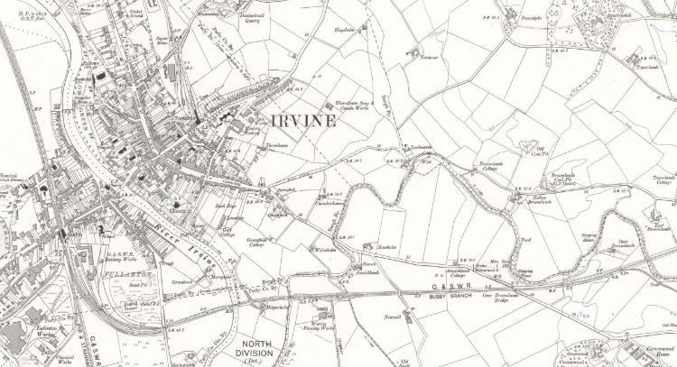
Collated by Emma Boyd East Ayrshire is a largely rural council area in the south-west of the country with a population of over 122,000 at the last census. The area was formed in 1996, from the former Kilmarnock and Loudoun, and Cumnock and Doon Valley districts; and the majority of people live in or around […]
Zoom Into Angus
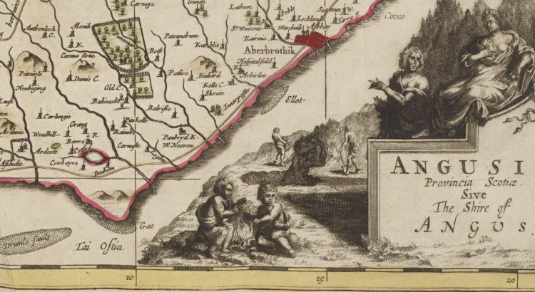
The Modern-day council area of Angus traces its name to an eighth century Pictish king, Óengus son of Fergus (ruled 732-761). Óengus (Angus) hailed from Circinn, one of the four principal Pictish kingdoms roughly coextensive with the modern county of Angus. The signing of the Declaration of Arbroath at Arbroath Abbey in 1320 marked Scotland’s establishment as an independent nation, and so Angus has become known as the birthplace of […]
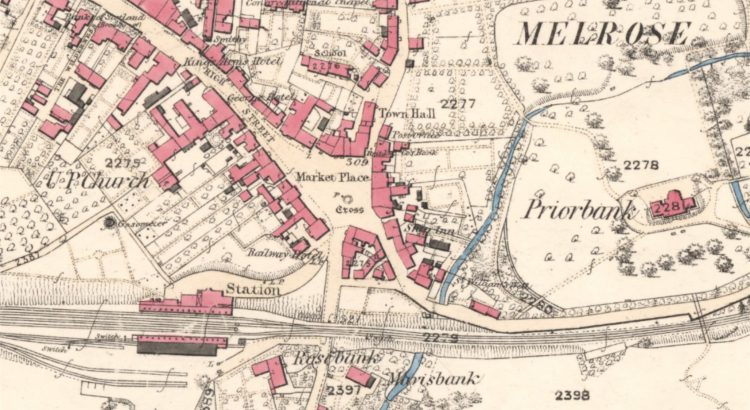
Zoom into the Scottish Borders
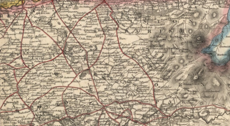
Collated by Charlotte James Robertson. The Scottish Borders, which are sometimes simply called The Borders, stretch from the Pentland Hills, which mark their boundary with the Lothians, to the River Tweed at the border with England. As an area of exceptional beauty the Scottish Borders have inspired writers like Sir Walter Scott and John Buchan. They are also home to several […]
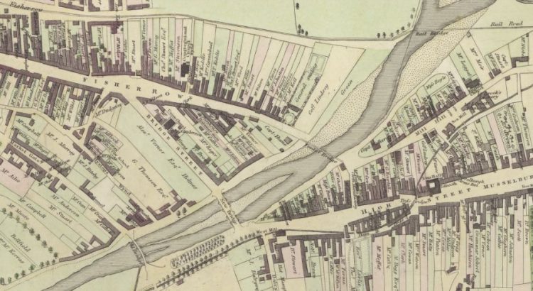
Zoom Into East Lothian
East Lothian, known as Haddingtonshire until 1921, sits to the east of Edinburgh. Local Government Reorganisation in 1975 saw it gain the coastal burgh of Musselburgh from neighbouring Midlothian. That town is now the largest in the county, closely followed by Dunbar and its county town of Haddington. Its situation between Edinburgh and England has seen it witness some of Scotland’s most […]
Festive films by the fireside
Now it’s December, we’re opening a selection box of festive films from the Moving Image Archive, not least because they can’t be shared on the big screen at the Library this year. Luckily, many films in the archive can be savoured wherever you are in the world. This short blog will showcase a few festive […]

Zoom into Moray
Collated by Moray Teale. Moray is situated in the north-east of Scotland and borders the Aberdeenshire and Highland council areas. Until 1996 Moray was also part of the Grampian Region. Moray has a varied landscape from the Moray Firth and largely flat coastline, to the hilly interior and several lochs. The River Spey runs through much of the area, which is famous for its whiskies and contains more […]
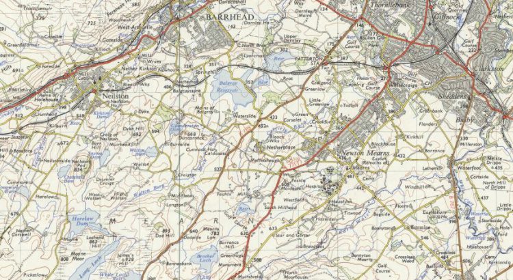
Zoom into East Renfrewshire
Historically, East Renfrewshire formed part of the larger Renfrewshire county. In the 1970s, most of the area broke away to become a new council district called Eastwood. The area was later renamed East Renfrewshire after gaining a part of Renfrew District (namely Barrhead) in 1996. Neighboured by the City of Glasgow to the northeast and […]