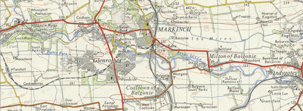
Collated by Peter Findlay. Aince a muckle pairt o Scotland’s industrial hertlaund, I recently heard “Fife” cried, “Scotland’s enchanting kingdom.” Ye micht be gast frae this nameliheid, hooiver, juist hae anither keek at this region afore makin judgement. For at truly is a pairt o oor country, whaur baith Fifers and veesitors alike, can gang on a byous an timeless journey o discovery. Believe me, […]
Category: Illustrations and photographs
Zoom into Aberdeenshire
Collated by Alison Leslie. Modern Aberdeenshire encompasses historic Aberdeenshire, Kincardineshire and part of Banffshire. To the south it borders Angus and Perth & Kinross, to the west Highland and Moray, and to the east Aberdeen City.
Zoom into Aberdeen City
Aberdeen City sits on the north-east coast of Scotland, north of the River Dee and south of the River Don. Aberdeen is often referred to the Granite or Silver City as the buildings were built with granite that has a high mica content (mica is a natural mineral that is typically very shiny or shimmery). […]
Zoom into Falkirk
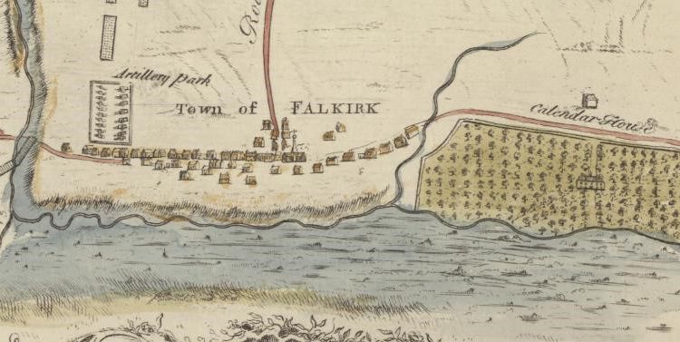
Collated by Moray Teale. The Falkirk council area was formed in 1996 when the Central Region was divided into several parts. Falkirk boasts many varied attractions from the ruins of the Antonine Wall, Callendar House and Blackness Castle to the engineering feats of the Forth and Clyde Canal and the Falkirk Wheel. More recently it has become famous for the […]
Zoom into Perth and Kinross
The county of Perth, formerly known as Perthshire, sits at the heart of Scotland, and its vast geographic size has seen it called ‘the big county.’ It existed as an administrative county from 1890 until 1930, when it was linked with Kinross-shire which, in direct contrast to its neighbour, is one of Scotland’s smallest counties. The county town is Perth, and a large number […]
Zoom into Dundee City
Collated by Lorna Black. Dundee is the fourth largest city in Scotland and lies on the north bank of the River Tay. Dundee is famous for three Js: Jute, Jam and Journalism. During the peak of jute production the city was nicknamed Juteolopis. It is also known for the Tay Bridge Disaster and RSS Discovery. […]
Zoom Into North Ayrshire
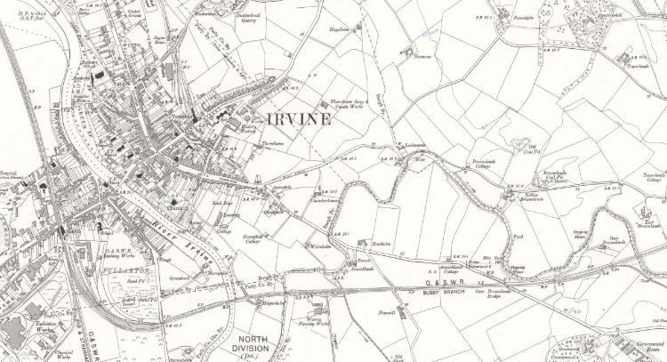
Collated by Emma Boyd North Ayrshire is a council area in the south-west of Scotland. Set along the coast of the Firth of Clyde and with a population of over 135,000 at the last census; it is the most populous of the three Ayrshire regions. The area was formed in 1996 from the former Cunninghame district, and includes the Isle of […]
Zoom Into East Ayrshire
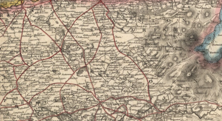
Collated by Emma Boyd East Ayrshire is a largely rural council area in the south-west of the country with a population of over 122,000 at the last census. The area was formed in 1996, from the former Kilmarnock and Loudoun, and Cumnock and Doon Valley districts; and the majority of people live in or around […]
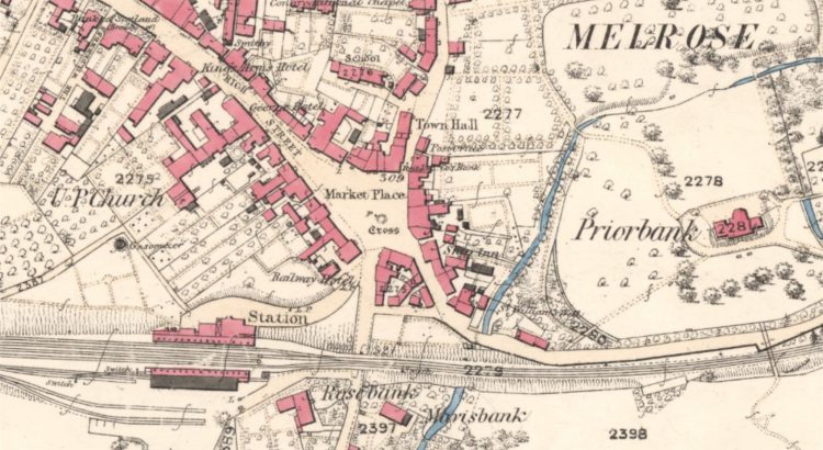
Zoom into the Scottish Borders
Collated by Charlotte James Robertson. The Scottish Borders, which are sometimes simply called The Borders, stretch from the Pentland Hills, which mark their boundary with the Lothians, to the River Tweed at the border with England. As an area of exceptional beauty the Scottish Borders have inspired writers like Sir Walter Scott and John Buchan. They are also home to several […]
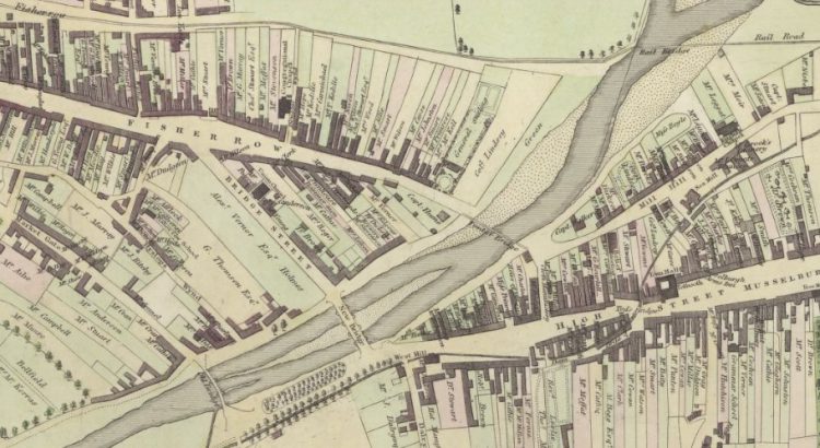
Zoom Into East Lothian
East Lothian, known as Haddingtonshire until 1921, sits to the east of Edinburgh. Local Government Reorganisation in 1975 saw it gain the coastal burgh of Musselburgh from neighbouring Midlothian. That town is now the largest in the county, closely followed by Dunbar and its county town of Haddington. Its situation between Edinburgh and England has seen it witness some of Scotland’s most […]